
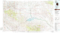
~ Globe AZ topo map, 1:100000 scale, 30 X 60 Minute, Historical, 1986, updated 1986
Globe, Arizona, USGS topographic map dated 1986.
Includes geographic coordinates (latitude and longitude). This topographic map is suitable for hiking, camping, and exploring, or framing it as a wall map.
Printed on-demand using high resolution imagery, on heavy weight and acid free paper, or alternatively on a variety of synthetic materials.
Topos available on paper, Waterproof, Poly, or Tyvek. Usually shipping rolled, unless combined with other folded maps in one order.
- Product Number: USGS-5549134
- Free digital map download (high-resolution, GeoPDF): Globe, Arizona (file size: 28 MB)
- Map Size: please refer to the dimensions of the GeoPDF map above
- Weight (paper map): ca. 55 grams
- Map Type: POD USGS Topographic Map
- Map Series: HTMC
- Map Verison: Historical
- Cell ID: 67580
- Scan ID: 315259
- Imprint Year: 1986
- Woodland Tint: Yes
- Aerial Photo Year: 1983
- Edit Year: 1986
- Datum: NAD27
- Map Projection: Universal Transverse Mercator
- Map published by United States Geological Survey
- Map Language: English
- Scanner Resolution: 600 dpi
- Map Cell Name: Globe
- Grid size: 30 X 60 Minute
- Date on map: 1986
- Map Scale: 1:100000
- Geographical region: Arizona, United States
Neighboring Maps:
All neighboring USGS topo maps are available for sale online at a variety of scales.
Spatial coverage:
Topo map Globe, Arizona, covers the geographical area associated the following places:
- Sonora - Peridot - Riverside - Top-of-the-World - Dimario Place - Miami - Ray - Ellison Place (historical) - Burch - Calva - Little Acres Mobile Home Park - San Carlos - Hayden Junction - Christmas - Hayden - Copper Hill - Pinal - Globe - Saguaro Mobile Home Park - Kelvin - Central Heights - Breezeway Trailer Park - Ray Junction - Natches - Kearny Mobile Home Park - August Hills Mobile Home Park - Alhambra Mobile Home Park - Miami Gardens - Midland City - Bylas - Troy - Cutter - Lower Miami - Globe Mobile Home Park - Coolidge Dam - Kearny - Inspiration - Claypool - Little Acres - Radium - Bellevue - Branaman - Rocky Junction - Emery - O'Banion Mobile Home Park - Geronimo
- Map Area ID: AREA33.533-111-110
- Northwest corner Lat/Long code: USGSNW33.5-111
- Northeast corner Lat/Long code: USGSNE33.5-110
- Southwest corner Lat/Long code: USGSSW33-111
- Southeast corner Lat/Long code: USGSSE33-110
- Northern map edge Latitude: 33.5
- Southern map edge Latitude: 33
- Western map edge Longitude: -111
- Eastern map edge Longitude: -110


