
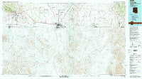
~ Douglas AZ topo map, 1:100000 scale, 30 X 60 Minute, Historical, 1994, updated 1994
Douglas, Arizona, USGS topographic map dated 1994.
Includes geographic coordinates (latitude and longitude). This topographic map is suitable for hiking, camping, and exploring, or framing it as a wall map.
Printed on-demand using high resolution imagery, on heavy weight and acid free paper, or alternatively on a variety of synthetic materials.
Topos available on paper, Waterproof, Poly, or Tyvek. Usually shipping rolled, unless combined with other folded maps in one order.
- Product Number: USGS-5549108
- Free digital map download (high-resolution, GeoPDF): Douglas, Arizona (file size: 26 MB)
- Map Size: please refer to the dimensions of the GeoPDF map above
- Weight (paper map): ca. 55 grams
- Map Type: POD USGS Topographic Map
- Map Series: HTMC
- Map Verison: Historical
- Cell ID: 67428
- Scan ID: 315247
- Imprint Year: 1994
- Woodland Tint: Yes
- Visual Version Number: 1
- Aerial Photo Year: 1991
- Edit Year: 1994
- Datum: NAD27
- Map Projection: Universal Transverse Mercator
- Map published by United States Geological Survey
- Map Language: English
- Scanner Resolution: 600 dpi
- Map Cell Name: Douglas
- Grid size: 30 X 60 Minute
- Date on map: 1994
- Map Scale: 1:100000
- Geographical region: Arizona, United States
Neighboring Maps:
All neighboring USGS topo maps are available for sale online at a variety of scales.
Spatial coverage:
Topo map Douglas, Arizona, covers the geographical area associated the following places:
- Warren - Corta Junction - Rileys El Encinar - Neff - Tintown - Forrest - Galena - Lowell - Bakerville - Cazador - Don Luis - Calumet - Douglas - Saginaw - Mount Vista Mobile Home Park - Double Adobe - Bisbee - Sunspots South Mobile Home Park - Paul Spur - Sieling's Mobile Village - Huachuca Terrace - Bisbee Junction - Naco - Highland Park - Pirtleville - Briggs - South Bisbee
- Map Area ID: AREA31.531-110-109
- Northwest corner Lat/Long code: USGSNW31.5-110
- Northeast corner Lat/Long code: USGSNE31.5-109
- Southwest corner Lat/Long code: USGSSW31-110
- Southeast corner Lat/Long code: USGSSE31-109
- Northern map edge Latitude: 31.5
- Southern map edge Latitude: 31
- Western map edge Longitude: -110
- Eastern map edge Longitude: -109


