
~ Davis Dam AZ topo map, 1:100000 scale, 30 X 60 Minute, Historical, 1982, updated 1983
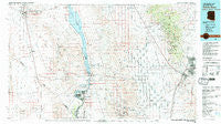
Davis Dam, Arizona, USGS topographic map dated 1982.
Includes geographic coordinates (latitude and longitude). This topographic map is suitable for hiking, camping, and exploring, or framing it as a wall map.
Printed on-demand using high resolution imagery, on heavy weight and acid free paper, or alternatively on a variety of synthetic materials.
Topos available on paper, Waterproof, Poly, or Tyvek. Usually shipping rolled, unless combined with other folded maps in one order.
- Product Number: USGS-5549104
- Free digital map download (high-resolution, GeoPDF): Davis Dam, Arizona (file size: 24 MB)
- Map Size: please refer to the dimensions of the GeoPDF map above
- Weight (paper map): ca. 55 grams
- Map Type: POD USGS Topographic Map
- Map Series: HTMC
- Map Verison: Historical
- Cell ID: 67386
- Scan ID: 315245
- Imprint Year: 1983
- Woodland Tint: Yes
- Aerial Photo Year: 1980
- Datum: NAD27
- Map Projection: Universal Transverse Mercator
- Map published by United States Geological Survey
- Map Language: English
- Scanner Resolution: 600 dpi
- Map Cell Name: Davis Dam
- Grid size: 30 X 60 Minute
- Date on map: 1982
- Map Scale: 1:100000
- Geographical region: Arizona, United States
Neighboring Maps:
All neighboring USGS topo maps are available for sale online at a variety of scales.
Spatial coverage:
Topo map Davis Dam, Arizona, covers the geographical area associated the following places:
- Terrin Mobile Home Park - Mojave City - Camp Sunrise (historical) - Carefree Resort Mobile Home Park - Golden Valley Mobile Home Park - Oatman - Stockton - Cerbat - Mesa Verde Mobile Home Park - Getz - Emerald City (historical) - Mohave Crossing - New Kingman - Longridge Mobile Home Park - Laughlin - Chloride - Davis Dam - Santiago Rodeo Villas Mobile Home Park - Santa Claus - Grasshopper Junction - Foothill Vista Mobile Home Park - Bullhead City - The Reserve at Fox Creek Mobile Home Park - Searchlight - Fort Piute (historical) - McConnico - Griffith - Drake - Riviera - Desert Sunset Trailer Park - Cal-Nev-Ari - Kerwin Camp (historical) - Katherine - Hilltop - Golden Valley - Hardyville (historical) - Kingman - Kingman Ranch Mobile Home Park - Harris
- Map Area ID: AREA35.535-115-114
- Northwest corner Lat/Long code: USGSNW35.5-115
- Northeast corner Lat/Long code: USGSNE35.5-114
- Southwest corner Lat/Long code: USGSSW35-115
- Southeast corner Lat/Long code: USGSSE35-114
- Northern map edge Latitude: 35.5
- Southern map edge Latitude: 35
- Western map edge Longitude: -115
- Eastern map edge Longitude: -114


