
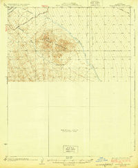
~ Buck Mountains AZ topo map, 1:62500 scale, 15 X 15 Minute, Historical, 1929
Buck Mountains, Arizona, USGS topographic map dated 1929.
Includes geographic coordinates (latitude and longitude). This topographic map is suitable for hiking, camping, and exploring, or framing it as a wall map.
Printed on-demand using high resolution imagery, on heavy weight and acid free paper, or alternatively on a variety of synthetic materials.
Topos available on paper, Waterproof, Poly, or Tyvek. Usually shipping rolled, unless combined with other folded maps in one order.
- Product Number: USGS-5547600
- Free digital map download (high-resolution, GeoPDF): Buck Mountains, Arizona (file size: 5 MB)
- Map Size: please refer to the dimensions of the GeoPDF map above
- Weight (paper map): ca. 55 grams
- Map Type: POD USGS Topographic Map
- Map Series: HTMC
- Map Verison: Historical
- Cell ID: 51871
- Scan ID: 314424
- Survey Year: 1927
- Datum: NAD
- Map Projection: Polyconic
- Preliminary map: Yes
- Map published by United States Geological Survey
- Map Language: English
- Scanner Resolution: 600 dpi
- Map Cell Name: Buck Mountains
- Grid size: 15 X 15 Minute
- Date on map: 1929
- Map Scale: 1:62500
- Geographical region: Arizona, United States
Neighboring Maps:
All neighboring USGS topo maps are available for sale online at a variety of scales.
Spatial coverage:
Topo map Buck Mountains, Arizona, covers the geographical area associated the following places:
- Crossman Peak - Deer Canyon Well - Shot Up Tank - Lower Tank - Shot Up Well - Massey Farm Airport - Scotts Well - Blacksmith Canyon Well - Lower Well - Cottonwood Spring - KZUL-FM (Lake Havasu City) - Sunrise Mine - Buck Mountains - Burro Canyon - Buck Mountain Wash - Jupiter Spring - Arrastra Well - Scotts Well - Blacksmith Canyon - Cow Creek - Deer Canyon - Arizona Yucca Mine - Ideal Mine - Palo Verde Mine - Jupiter Mine - Sagebrush Trails Estates Airport - Pittsburg Mine - Burro Well - Burro and Cottonwood Well
- Map Area ID: AREA34.7534.5-114.25-114
- Northwest corner Lat/Long code: USGSNW34.75-114.25
- Northeast corner Lat/Long code: USGSNE34.75-114
- Southwest corner Lat/Long code: USGSSW34.5-114.25
- Southeast corner Lat/Long code: USGSSE34.5-114
- Northern map edge Latitude: 34.75
- Southern map edge Latitude: 34.5
- Western map edge Longitude: -114.25
- Eastern map edge Longitude: -114


