
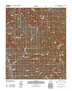
~ Rockinstraw Mountain AZ topo map, 1:24000 scale, 7.5 X 7.5 Minute, Historical, 2011
Rockinstraw Mountain, Arizona, USGS topographic map dated 2011.
Includes geographic coordinates (latitude and longitude). This topographic map is suitable for hiking, camping, and exploring, or framing it as a wall map.
Printed on-demand using high resolution imagery, on heavy weight and acid free paper, or alternatively on a variety of synthetic materials.
Topos available on paper, Waterproof, Poly, or Tyvek. Usually shipping rolled, unless combined with other folded maps in one order.
- Product Number: USGS-5547044
- Free digital map download (high-resolution, GeoPDF): Rockinstraw Mountain, Arizona (file size: 26 MB)
- Map Size: please refer to the dimensions of the GeoPDF map above
- Weight (paper map): ca. 55 grams
- Map Type: POD USGS Topographic Map
- Map Series: US Topo
- Map Verison: Historical
- Cell ID: 38314
- Datum: North American Datum of 1983
- Map Projection: Transverse Mercator
- Map Cell Name: Rockinstraw Mountain
- Grid size: 7.5 X 7.5 Minute
- Date on map: 2011
- Map Scale: 1:24000
- Geographical region: Arizona, United States
Neighboring Maps:
All neighboring USGS topo maps are available for sale online at a variety of scales.
Spatial coverage:
Topo map Rockinstraw Mountain, Arizona, covers the geographical area associated the following places:
- Little Brewster Spring - Granite Spring - Horse Spring - Grapevine Spring - Ash Spring - Richmond Basin - Price Tank - Tom Camp Spring - Jump-off Spring - Lower Mud Spring - Rockinstraw Tank Number Two - Cement Spring - Nugget Wash Spring - Wood Springs Wash - Wood Road Well - Big Pasture Well - Shute Road Number 2 Tank - Hicks Wash - Shute Road Well - Murray Wash - Granite Spring - Globe Division (historical) - Rockinstraw Tank - Alamo Ranger Station - Cherry Spring - Mint Spring - Jackson Tank - Bixby Well - Rockinstraw Mountain - Rough Canyon Tank - Negro Wash - Globe-Miami Division - Redmond Mountain - Brush Spring - Cold Water Seep - Apache Tank Number Two - Wood Spring - Procopio Spring - Redmond Well - Nugget Mesa - Riley Well - Apache Tank - Kyles Tank - Cottonwood Spring - Upper Well - Big Pond Tank - Brewster Well - Squaw Peak - Ginn Spring - Granite Peak - Cherry Horizontal Spring - Little Mud Well - New Water Well - Dry Weather Ford Tank - Hackberry Spring - Summit Tank - Rocky Tank - Summit Well - Jump-off Spring - Negro Well - Horseshoe Bend Wash - Redmond Tank - Sycamore Well - Brewster Well - Rays Tank - Sycamore Spring - Lower Well
- Map Area ID: AREA33.62533.5-110.875-110.75
- Northwest corner Lat/Long code: USGSNW33.625-110.875
- Northeast corner Lat/Long code: USGSNE33.625-110.75
- Southwest corner Lat/Long code: USGSSW33.5-110.875
- Southeast corner Lat/Long code: USGSSE33.5-110.75
- Northern map edge Latitude: 33.625
- Southern map edge Latitude: 33.5
- Western map edge Longitude: -110.875
- Eastern map edge Longitude: -110.75


