
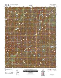
~ Carrizo SE AZ topo map, 1:24000 scale, 7.5 X 7.5 Minute, Historical, 2011
Carrizo SE, Arizona, USGS topographic map dated 2011.
Includes geographic coordinates (latitude and longitude). This topographic map is suitable for hiking, camping, and exploring, or framing it as a wall map.
Printed on-demand using high resolution imagery, on heavy weight and acid free paper, or alternatively on a variety of synthetic materials.
Topos available on paper, Waterproof, Poly, or Tyvek. Usually shipping rolled, unless combined with other folded maps in one order.
- Product Number: USGS-5546964
- Free digital map download (high-resolution, GeoPDF): Carrizo SE, Arizona (file size: 27 MB)
- Map Size: please refer to the dimensions of the GeoPDF map above
- Weight (paper map): ca. 55 grams
- Map Type: POD USGS Topographic Map
- Map Series: US Topo
- Map Verison: Historical
- Cell ID: 7391
- Datum: North American Datum of 1983
- Map Projection: Transverse Mercator
- Map Cell Name: Carrizo SE
- Grid size: 7.5 X 7.5 Minute
- Date on map: 2011
- Map Scale: 1:24000
- Geographical region: Arizona, United States
Neighboring Maps:
All neighboring USGS topo maps are available for sale online at a variety of scales.
Spatial coverage:
Topo map Carrizo SE, Arizona, covers the geographical area associated the following places:
- KM Mine - Spoon Tank - Bull Butte - Clover Tank - Little Trough Creek - Mesquite Tank - Quail Tank - John Moore Spring - Bill Schroeder Tank - Mine Tank - Bonehead Tank - Ridge Tank Number One - Swede Spring - Soda Spring - Bonehead Catchment - Abdoul Canyon - Louse Tank Number One - Cowboy Tank - Bonehead Spring - Old R Spring - Alkali Canyon - Golden Roll Spring - Swede Tank - Cowboy Butte - Skeleton Tank - Trail Tank - Cedar Creek - Warm Spring - John Moore Tank - Drift Fence Tank - Carrizo Creek - Bog Spring - Fort Apache Division - Mine Tank Number Two - Side Oat Tank - Mescal Tank - Popcorn Canyon - Rim Pit Tank
- Map Area ID: AREA33.87533.75-110.375-110.25
- Northwest corner Lat/Long code: USGSNW33.875-110.375
- Northeast corner Lat/Long code: USGSNE33.875-110.25
- Southwest corner Lat/Long code: USGSSW33.75-110.375
- Southeast corner Lat/Long code: USGSSE33.75-110.25
- Northern map edge Latitude: 33.875
- Southern map edge Latitude: 33.75
- Western map edge Longitude: -110.375
- Eastern map edge Longitude: -110.25


