
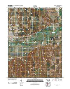
~ McCook East NE topo map, 1:24000 scale, 7.5 X 7.5 Minute, Historical, 2011
McCook East, Nebraska, USGS topographic map dated 2011.
Includes geographic coordinates (latitude and longitude). This topographic map is suitable for hiking, camping, and exploring, or framing it as a wall map.
Printed on-demand using high resolution imagery, on heavy weight and acid free paper, or alternatively on a variety of synthetic materials.
Topos available on paper, Waterproof, Poly, or Tyvek. Usually shipping rolled, unless combined with other folded maps in one order.
- Product Number: USGS-5546884
- Free digital map download (high-resolution, GeoPDF): McCook East, Nebraska (file size: 16 MB)
- Map Size: please refer to the dimensions of the GeoPDF map above
- Weight (paper map): ca. 55 grams
- Map Type: POD USGS Topographic Map
- Map Series: US Topo
- Map Verison: Historical
- Cell ID: 28285
- Datum: North American Datum of 1983
- Map Projection: Transverse Mercator
- Map Cell Name: McCook East
- Grid size: 7.5 X 7.5 Minute
- Date on map: 2011
- Map Scale: 1:24000
- Geographical region: Nebraska, United States
Neighboring Maps:
All neighboring USGS topo maps are available for sale online at a variety of scales.
Spatial coverage:
Topo map McCook East, Nebraska, covers the geographical area associated the following places:
- Peace Lutheran Church - McCook Community College - McMillen Hall - Church of Christ - Kelley Park - Saint John Church - First Baptist Church - Township of Valley Grange - Township of Willow Grove - Saint Patricks Elementary School - Brooks Hall - Valley Grange Election Precinct - Kelley Creek - The Church of Jesus Christ of Latter Day Saints - Wigwam Student Center - Museum DAR - Von Riesen Library - Elks Ball Park - Weiland Field - Walsh-Brady Hall - Heritage Hills Golf Course - East Kelley Creek - First Congregational Church - McCook Christian Church - Barnett Hall - Felling Field - West Kelley Creek - East Ward Elementary School - Dry Creek - Meeker Extension Canal - Our Saviors Lutheran Church - Assembly of God Church - City of McCook - McCook Beauty Academy - Valley Baptist Church - School Number 31 - Willow Grove Election Precinct - Burnett Park - McCook Eye Clinic - River Canyon - Tipton Building - True Hall - Saint Patricks Catholic Church - Brushy Creek - Mc Cook Ben Nelson Regional Airport - Community Hospital - McCook Clinic - Evangelical Free Church - Saint John Cemetery - Republican Valley School - Wrightstone Fine Arts Building - McCook
- Map Area ID: AREA40.2540.125-100.625-100.5
- Northwest corner Lat/Long code: USGSNW40.25-100.625
- Northeast corner Lat/Long code: USGSNE40.25-100.5
- Southwest corner Lat/Long code: USGSSW40.125-100.625
- Southeast corner Lat/Long code: USGSSE40.125-100.5
- Northern map edge Latitude: 40.25
- Southern map edge Latitude: 40.125
- Western map edge Longitude: -100.625
- Eastern map edge Longitude: -100.5


