
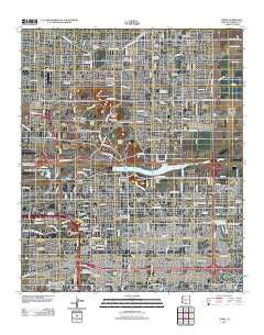
~ Tempe AZ topo map, 1:24000 scale, 7.5 X 7.5 Minute, Historical, 2011
Tempe, Arizona, USGS topographic map dated 2011.
Includes geographic coordinates (latitude and longitude). This topographic map is suitable for hiking, camping, and exploring, or framing it as a wall map.
Printed on-demand using high resolution imagery, on heavy weight and acid free paper, or alternatively on a variety of synthetic materials.
Topos available on paper, Waterproof, Poly, or Tyvek. Usually shipping rolled, unless combined with other folded maps in one order.
- Product Number: USGS-5546488
- Free digital map download (high-resolution, GeoPDF): Tempe, Arizona (file size: 28 MB)
- Map Size: please refer to the dimensions of the GeoPDF map above
- Weight (paper map): ca. 55 grams
- Map Type: POD USGS Topographic Map
- Map Series: US Topo
- Map Verison: Historical
- Cell ID: 44507
- Datum: North American Datum of 1983
- Map Projection: Transverse Mercator
- Map Cell Name: Tempe
- Grid size: 7.5 X 7.5 Minute
- Date on map: 2011
- Map Scale: 1:24000
- Geographical region: Arizona, United States
Neighboring Maps:
All neighboring USGS topo maps are available for sale online at a variety of scales.
Spatial coverage:
Topo map Tempe, Arizona, covers the geographical area associated the following places:
- Tempe Travel Trailer Villa - Tempe Cascade - Starlite Trailer Park - Redwood Gardens Mobile Home Park - Tovrea - Horseshoe Mobile Home Park - Lariat Tra-Tel Trailer Court - Shadow Mountain Village Scottsdale - Reynolds Trailer Court - Big Palm Trailer Park - Wagon Wheel Mobile Ranch - Big Pine Mobile Home Park - Chaparral Mobile Village - Admiral Trailer Park - Wheel Inn Ranch Mobile Home Park - Shadow Mountain Village - Contempo Tempe - Paradise View Mobile Home Park - Parkview Village Mobile Home and Recreational Vehicle Park - Tempe Junction - Rancho Tempe Family and Adult Mobile Home Park - Scottsdale Trailer Corral - Hyde Park Lodge - Papago Peaks Village - El Dorado Mobile Home Resort - Roadrunner Lake Resort Mobile Home Park - Dobson Shores - Pueblo Sereno Mobile Home Park - Montecito Mobile Home Estates - Tempe - Rancho Rio Vista Mobile Home Park - Scottsdale Mobile Home Park - Palo Verde Mobile Manor - Minnesota Court - Cimarron - Tempe Cascade Mobile Home Estates - Knoell East - Contempo Tempe Mobile Home Park - Desert Sage Mobile Manor - Shady Ranch Trailer Lodge - Greenhaven Mobile Park - Normal Junction - Wheel Inn Ranch - Peterson (historical) - McClintock Manor - Green Acres Trailer Court - University Mobile Home Park - Mountain View Mobile Home Park - Riviera Mobile Home Park - The Meadows Mobile Home Park - Marlborough Park - Peterson - Cibola Mobile Home Park - The Trails III - Pony Acres Mobile Home Park
- Map Area ID: AREA33.533.375-112-111.875
- Northwest corner Lat/Long code: USGSNW33.5-112
- Northeast corner Lat/Long code: USGSNE33.5-111.875
- Southwest corner Lat/Long code: USGSSW33.375-112
- Southeast corner Lat/Long code: USGSSE33.375-111.875
- Northern map edge Latitude: 33.5
- Southern map edge Latitude: 33.375
- Western map edge Longitude: -112
- Eastern map edge Longitude: -111.875


