
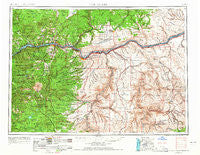
~ The Dalles OR topo map, 1:250000 scale, 1 X 2 Degree, Historical, 1953, updated 1965
The Dalles, Oregon, USGS topographic map dated 1953.
Includes geographic coordinates (latitude and longitude). This topographic map is suitable for hiking, camping, and exploring, or framing it as a wall map.
Printed on-demand using high resolution imagery, on heavy weight and acid free paper, or alternatively on a variety of synthetic materials.
Topos available on paper, Waterproof, Poly, or Tyvek. Usually shipping rolled, unless combined with other folded maps in one order.
- Product Number: USGS-5545912
- Free digital map download (high-resolution, GeoPDF): The Dalles, Oregon (file size: 23 MB)
- Map Size: please refer to the dimensions of the GeoPDF map above
- Weight (paper map): ca. 55 grams
- Map Type: POD USGS Topographic Map
- Map Series: HTMC
- Map Verison: Historical
- Cell ID: 69051
- Scan ID: 283356
- Imprint Year: 1965
- Woodland Tint: Yes
- Aerial Photo Year: 1952
- Edit Year: 1964
- Field Check Year: 1953
- Datum: Unstated
- Map Projection: Transverse Mercator
- Map published by United States Geological Survey
- Map Language: English
- Scanner Resolution: 600 dpi
- Map Cell Name: The Dalles
- Grid size: 1 X 2 Degree
- Date on map: 1953
- Map Scale: 1:250000
- Geographical region: Oregon, United States
Neighboring Maps:
All neighboring USGS topo maps are available for sale online at a variety of scales.
Spatial coverage:
Topo map The Dalles, Oregon, covers the geographical area associated the following places:
- Saint Martins Hot Springs - Fargher (historical) - Carson - Pleasant Valley - Dee - Goodnoe Hills - Thornberry - Boyd - Wapinitia - Warwick - Stabler - Klondike - Klickitat - Hood River - Mosier - Dufur - Wishram Heights - Cherry Heights - Bingen - Montague (historical) - Bates - White Salmon - Moona - Centerville - The Dalles - Maryhill - Condon - Guler - Friend - Sundale - Maupin - Alville (historical) - Tygh Valley - Monkland - Hood - Mayville - Igo (historical) - De Moss Springs - Klickitat Springs - Laurel - Kent - North Bonneville - Olex - Klickitat Heights - Celilo Village - Oak Grove - Snowden - Mountain Air Park - Dallesport - Moffetts Hot Springs - Lyle - Early (historical) - Rhododendron - East Maupin - Lost Lake Resort - Pine Grove - Dot - Gooseneck - Laws Corner - Fort Rains - Arlington - Moro - Roosevelt - Cook - Chenoweth - Rutledge - Faubion - Rock Creek - Trout Lake - Bickleton - Goldendale - Smithville - Sinks (historical) - Mountain Brook - Emigrant Springs (historical) - Parkdale - Fairbanks - Mount Hood - Gilmer - Grass Valley - Straight Point - Wishram - Kingsley - Mikkalo - Rowena - Goodnoe - Wemme - Wahkiacus - Mill A - Home Valley - Nansene - Petersburg - Pine Hollow - Clem - Biggs Junction - Mount Hood Village - Underwood Heights - Husum - Criterion (historical) - Rockford
- Map Area ID: AREA4645-122-120
- Northwest corner Lat/Long code: USGSNW46-122
- Northeast corner Lat/Long code: USGSNE46-120
- Southwest corner Lat/Long code: USGSSW45-122
- Southeast corner Lat/Long code: USGSSE45-120
- Northern map edge Latitude: 46
- Southern map edge Latitude: 45
- Western map edge Longitude: -122
- Eastern map edge Longitude: -120


