
~ Roseburg OR topo map, 1:250000 scale, 1 X 2 Degree, Historical, 1958, updated 1960
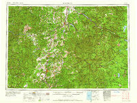
Roseburg, Oregon, USGS topographic map dated 1958.
Includes geographic coordinates (latitude and longitude). This topographic map is suitable for hiking, camping, and exploring, or framing it as a wall map.
Printed on-demand using high resolution imagery, on heavy weight and acid free paper, or alternatively on a variety of synthetic materials.
Topos available on paper, Waterproof, Poly, or Tyvek. Usually shipping rolled, unless combined with other folded maps in one order.
- Product Number: USGS-5545908
- Free digital map download (high-resolution, GeoPDF): Roseburg, Oregon (file size: 27 MB)
- Map Size: please refer to the dimensions of the GeoPDF map above
- Weight (paper map): ca. 55 grams
- Map Type: POD USGS Topographic Map
- Map Series: HTMC
- Map Verison: Historical
- Cell ID: 68993
- Scan ID: 283350
- Imprint Year: 1960
- Woodland Tint: Yes
- Field Check Year: 1958
- Datum: Unstated
- Map Projection: Transverse Mercator
- Map published by United States Geological Survey
- Map published by United States Army Corps of Engineers
- Map published by United States Army
- Map Language: English
- Scanner Resolution: 600 dpi
- Map Cell Name: Roseburg
- Grid size: 1 X 2 Degree
- Date on map: 1958
- Map Scale: 1:250000
- Geographical region: Oregon, United States
Neighboring Maps:
All neighboring USGS topo maps are available for sale online at a variety of scales.
Spatial coverage:
Topo map Roseburg, Oregon, covers the geographical area associated the following places:
- Scottsburg - Rockland (historical) - Green Acres - Siuslaw (historical) - Oaks - Wolf Creek - Sutherlin - Oakridge - Brockway - Gap - Rice Hill - Union Gap - Calvert (historical) - Cottage Grove - Earl (historical) - Black Butte - Nugget (historical) - Edenbower - Dorena - Millwood - Comstock - Clearwater - Civil Bend (historical) - Elgarose - Hawthorne - Fox Hollow (historical) - Buck Fork (historical) - North Fork - Glide - Royal - Sitkum - Lorane - Veatch - Leona - Oakland - Lowell - Mill Camp - Mound (historical) - Melrose - Round Prairie - Tyee - Winberry - Olalla - Callahan - Fair Oaks - Elkhead - Crow - Winchester - Fall Creek - Ash - Dexter - Dixonville - Cloverdale - Weaver - McCredie Springs - London - Cleveland - Dora - Diamond Lake - Camas Valley - Saginaw - Glenwood (historical) - Calkins - Stephens - Kellogg - Walker - Steamboat - Culp Creek - Myrtle Creek - Winston - Tenmile - Goshen - Coles Valley - Walden - Jasper - Gunter - Riversdale - Westfir - Yoncalla - Wallace (historical) - Remote - Disston - Porter Creek - Green - Wilbur - Peel - Roseburg - Dillard - Reston - Dorena (historical) - Amos (historical) - Armet (historical) - Old Town - Alma - Willamette City - Toketee Falls - Bohemia (historical) - Latham - Hoaglin (historical) - Curtin
- Map Area ID: AREA4443-124-122
- Northwest corner Lat/Long code: USGSNW44-124
- Northeast corner Lat/Long code: USGSNE44-122
- Southwest corner Lat/Long code: USGSSW43-124
- Southeast corner Lat/Long code: USGSSE43-122
- Northern map edge Latitude: 44
- Southern map edge Latitude: 43
- Western map edge Longitude: -124
- Eastern map edge Longitude: -122


