
~ Medford OR topo map, 1:250000 scale, 1 X 2 Degree, Historical, 1955, updated 1964
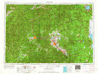
Medford, Oregon, USGS topographic map dated 1955.
Includes geographic coordinates (latitude and longitude). This topographic map is suitable for hiking, camping, and exploring, or framing it as a wall map.
Printed on-demand using high resolution imagery, on heavy weight and acid free paper, or alternatively on a variety of synthetic materials.
Topos available on paper, Waterproof, Poly, or Tyvek. Usually shipping rolled, unless combined with other folded maps in one order.
- Product Number: USGS-5545890
- Free digital map download (high-resolution, GeoPDF): Medford, Oregon (file size: 26 MB)
- Map Size: please refer to the dimensions of the GeoPDF map above
- Weight (paper map): ca. 55 grams
- Map Type: POD USGS Topographic Map
- Map Series: HTMC
- Map Verison: Historical
- Cell ID: 75014
- Scan ID: 283341
- Imprint Year: 1964
- Woodland Tint: Yes
- Aerial Photo Year: 1955
- Edit Year: 1963
- Field Check Year: 1955
- Datum: Unstated
- Map Projection: Transverse Mercator
- Map published by United States Geological Survey
- Map published by United States Army Corps of Engineers
- Map published by United States Army
- Map Language: English
- Scanner Resolution: 600 dpi
- Map Cell Name: Medford
- Grid size: 1 X 2 Degree
- Date on map: 1955
- Map Scale: 1:250000
- Geographical region: Oregon, United States
Neighboring Maps:
All neighboring USGS topo maps are available for sale online at a variety of scales.
Spatial coverage:
Topo map Medford, Oregon, covers the geographical area associated the following places:
- Rand - Lake Creek - Seven Oaks - White City - New Hope - Speaker - Takilma - Riddle - Buckhorn Springs - Recreation (historical) - Sams Valley - Dardanelles - Climax - Grants Pass - Tri-City - Surprise Valley - Holland - Fruitdale - Althouse (historical) - Pinehurst - Bitter Lick - Dads Creek - Ruch - Allentown (historical) - Persist (historical) - Wonder - Potter Mill (historical) - Drew - Talent - McKee Bridge - Wellen (historical) - Placer - California Bar - Kerby - Central Point - Leland - Prospect - Quines Creek - Bybee Corner - Milo - Gold Hill - Marial - Etna (historical) - Lincoln - Rocky Point - Phoenix - Anchor (historical) - Cole - Dryden - Spikenard (historical) - Browntown - Azalea - Three Pines - Colestin - Table Rock - Trail - Four Corners - Lavadoure (historical) - Williamsburg (historical) - Perdue (historical) - Rogue River - Perrydale (historical) - Galice - Brown City (historical) - Medford - Golden - Derby (historical) - Cameron (historical) - O'Brien - Barron (historical) - Applegate - Lake of the Woods - Cascade Gorge - Copper - Tri City - Browntown (historical) - Rogue Elk - Sunny Valley - Dudley (historical) - Wilderville - Williams - Redwood - Wimer - Murphy - Pokegama (historical) - Butte Falls - Brownsboro - Draper (historical) - Asbestos (historical) - Greenback (historical) - McLeod - Bridgeview - Fortune Branch - Steamboat - Clover Station (historical) - Edsalla (historical) - Jacksonville - Galesville - Union Creek - Eagle Point
- Map Area ID: AREA4342-124-122
- Northwest corner Lat/Long code: USGSNW43-124
- Northeast corner Lat/Long code: USGSNE43-122
- Southwest corner Lat/Long code: USGSSW42-124
- Southeast corner Lat/Long code: USGSSE42-122
- Northern map edge Latitude: 43
- Southern map edge Latitude: 42
- Western map edge Longitude: -124
- Eastern map edge Longitude: -122


