
~ Jordan Valley OR topo map, 1:250000 scale, 1 X 2 Degree, Historical, 1958, updated 1958
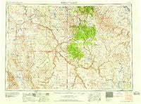
Jordan Valley, Oregon, USGS topographic map dated 1958.
Includes geographic coordinates (latitude and longitude). This topographic map is suitable for hiking, camping, and exploring, or framing it as a wall map.
Printed on-demand using high resolution imagery, on heavy weight and acid free paper, or alternatively on a variety of synthetic materials.
Topos available on paper, Waterproof, Poly, or Tyvek. Usually shipping rolled, unless combined with other folded maps in one order.
- Product Number: USGS-5545866
- Free digital map download (high-resolution, GeoPDF): Jordan Valley, Oregon (file size: 19 MB)
- Map Size: please refer to the dimensions of the GeoPDF map above
- Weight (paper map): ca. 55 grams
- Map Type: POD USGS Topographic Map
- Map Series: HTMC
- Map Verison: Historical
- Cell ID: 68847
- Scan ID: 283321
- Imprint Year: 1958
- Woodland Tint: Yes
- Visual Version Number: 1
- Field Check Year: 1955
- Datum: Unstated
- Map Projection: Transverse Mercator
- Map published by United States Geological Survey
- Map published by United States Army Corps of Engineers
- Map published by United States Army
- Map Language: English
- Scanner Resolution: 600 dpi
- Map Cell Name: Jordan Valley
- Grid size: 1 X 2 Degree
- Date on map: 1958
- Map Scale: 1:250000
- Geographical region: Oregon, United States
Neighboring Maps:
All neighboring USGS topo maps are available for sale online at a variety of scales.
Spatial coverage:
Topo map Jordan Valley, Oregon, covers the geographical area associated the following places:
- Collier Place - Jordan Valley - Miller Creek Settlement - Danner - Carothers Place (historical) - Triangle - South Mountain - Doyle Place - Cottonwood (historical) - Grand View - Empire City (historical) - Dickshooter - Arock - Comical Turn - Basque - Cliffs - Riddle - Buncel Place - Dry Forty - Four Corners - Pleasant Valley Place - Harvey Place - Rickard Crossing - Crill Place - Spiry Place - Flint - Rome - Fairylawn
- Map Area ID: AREA4342-118-116
- Northwest corner Lat/Long code: USGSNW43-118
- Northeast corner Lat/Long code: USGSNE43-116
- Southwest corner Lat/Long code: USGSSW42-118
- Southeast corner Lat/Long code: USGSSE42-116
- Northern map edge Latitude: 43
- Southern map edge Latitude: 42
- Western map edge Longitude: -118
- Eastern map edge Longitude: -116


