
~ Canyon City OR topo map, 1:250000 scale, 1 X 2 Degree, Historical, 1959, updated 1959
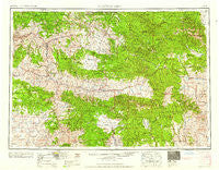
Canyon City, Oregon, USGS topographic map dated 1959.
Includes geographic coordinates (latitude and longitude). This topographic map is suitable for hiking, camping, and exploring, or framing it as a wall map.
Printed on-demand using high resolution imagery, on heavy weight and acid free paper, or alternatively on a variety of synthetic materials.
Topos available on paper, Waterproof, Poly, or Tyvek. Usually shipping rolled, unless combined with other folded maps in one order.
- Product Number: USGS-5545848
- Free digital map download (high-resolution, GeoPDF): Canyon City, Oregon (file size: 25 MB)
- Map Size: please refer to the dimensions of the GeoPDF map above
- Weight (paper map): ca. 55 grams
- Map Type: POD USGS Topographic Map
- Map Series: HTMC
- Map Verison: Historical
- Cell ID: 68701
- Scan ID: 283308
- Imprint Year: 1959
- Woodland Tint: Yes
- Field Check Year: 1955
- Datum: Unstated
- Map Projection: Transverse Mercator
- Map published by United States Army Corps of Engineers
- Map published by United States Army
- Map Language: English
- Scanner Resolution: 600 dpi
- Map Cell Name: Canyon City
- Grid size: 1 X 2 Degree
- Date on map: 1959
- Map Scale: 1:250000
- Geographical region: Oregon, United States
Neighboring Maps:
All neighboring USGS topo maps are available for sale online at a variety of scales.
Spatial coverage:
Topo map Canyon City, Oregon, covers the geographical area associated the following places:
- Kimberly - Little Alps - Hereford - McEwen - Bourne - Richmond - Range - Cracker City (historical) - John Day - Monument - Courtrock - Susanville - Rock Creek - Izee - Bates - Silvies - Prairie City - Galena - Hamilton - Whitney (historical) - Audrey (historical) - Suplee - Unity - Spoos Mill - Carroll (historical) - Ritter - Parkersville (historical) - Granite - Seneca - Dayville - Three Forks - Paulina - Porterville (historical) - Long Creek - Sumpter - Frost Mill - Fox - Canyon City - Cableville (historical) - Dale - Caverhill (historical) - Austin - Greenhorn - Spray - Mount Vernon - Caleb (historical) - Robinsonville - Waterman (historical) - Antone (historical) - Cabell City - Beech Creek
- Map Area ID: AREA4544-120-118
- Northwest corner Lat/Long code: USGSNW45-120
- Northeast corner Lat/Long code: USGSNE45-118
- Southwest corner Lat/Long code: USGSSW44-120
- Southeast corner Lat/Long code: USGSSE44-118
- Northern map edge Latitude: 45
- Southern map edge Latitude: 44
- Western map edge Longitude: -120
- Eastern map edge Longitude: -118


