
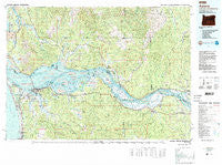
~ Astoria OR topo map, 1:100000 scale, 30 X 60 Minute, Historical, 1981, updated 1989
Astoria, Oregon, USGS topographic map dated 1981.
Includes geographic coordinates (latitude and longitude). This topographic map is suitable for hiking, camping, and exploring, or framing it as a wall map.
Printed on-demand using high resolution imagery, on heavy weight and acid free paper, or alternatively on a variety of synthetic materials.
Topos available on paper, Waterproof, Poly, or Tyvek. Usually shipping rolled, unless combined with other folded maps in one order.
- Product Number: USGS-5545654
- Free digital map download (high-resolution, GeoPDF): Astoria, Oregon (file size: 34 MB)
- Map Size: please refer to the dimensions of the GeoPDF map above
- Weight (paper map): ca. 55 grams
- Map Type: POD USGS Topographic Map
- Map Series: HTMC
- Map Verison: Historical
- Cell ID: 67071
- Scan ID: 283047
- Imprint Year: 1989
- Woodland Tint: Yes
- Aerial Photo Year: 1979
- Edit Year: 1981
- Datum: NAD27
- Map Projection: Universal Transverse Mercator
- Map published by United States Geological Survey
- Map Language: English
- Scanner Resolution: 600 dpi
- Map Cell Name: Astoria
- Grid size: 30 X 60 Minute
- Date on map: 1981
- Map Scale: 1:100000
- Geographical region: Oregon, United States
Neighboring Maps:
All neighboring USGS topo maps are available for sale online at a variety of scales.
Spatial coverage:
Topo map Astoria, Oregon, covers the geographical area associated the following places:
- Ryderwood - Hammond - Brookfield - Wauna - Flavel (historical) - Mayger - Eufaula Heights - Clatskanie - Indian Village Mobile Home Park - Brownsmead - Melville - Clifton - Oklahoma Hill - Hudson (historical) - Fort Stevens - Knappton - Burnside (historical) - Coal Creek - Blind Slough (historical) - Sleepy Hollow - Fishhawk (historical) - Altoona - McGowan - Uniontown - Marshland - Svensen Junction - Svensens Landing - Delena - Eagle Cliff - Bunker Hill - Grays River - Carlson Landing - Chadwell (historical) - Oneida - Fern Hill - East Cathlamet - Jeffers Garden - Svensen - Astoria - Warrenton - Eufaula - Kerry - Carnahan - Stringtown - Deep River - Tongue Point Village - Frankfort - Sunset Beach - Apiary - Quincy - Westport - Biddle (historical) - Knappa - Cathlamet - State Camp - Inglis - Olney - Waterford - Rosburg - Naselle - Surf Pines - Taylorville - Bradwood - Megler - Middle Nemah - Miles Crossing - Dahlia - Flandersville - Skamokawa - Wildwood - Chinook - Navy Heights - Alston - Clatskanie Heights - Upper Salmon Junction - Woodson - Kyser (historical) - Gearhart - Eden - Oak Point - Stella
- Map Area ID: AREA46.546-124-123
- Northwest corner Lat/Long code: USGSNW46.5-124
- Northeast corner Lat/Long code: USGSNE46.5-123
- Southwest corner Lat/Long code: USGSSW46-124
- Southeast corner Lat/Long code: USGSSE46-123
- Northern map edge Latitude: 46.5
- Southern map edge Latitude: 46
- Western map edge Longitude: -124
- Eastern map edge Longitude: -123


