
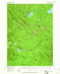
~ Summit Lake OR topo map, 1:62500 scale, 15 X 15 Minute, Historical, 1956, updated 1961
Summit Lake, Oregon, USGS topographic map dated 1956.
Includes geographic coordinates (latitude and longitude). This topographic map is suitable for hiking, camping, and exploring, or framing it as a wall map.
Printed on-demand using high resolution imagery, on heavy weight and acid free paper, or alternatively on a variety of synthetic materials.
Topos available on paper, Waterproof, Poly, or Tyvek. Usually shipping rolled, unless combined with other folded maps in one order.
- Product Number: USGS-5545422
- Free digital map download (high-resolution, GeoPDF): Summit Lake, Oregon (file size: 9 MB)
- Map Size: please refer to the dimensions of the GeoPDF map above
- Weight (paper map): ca. 55 grams
- Map Type: POD USGS Topographic Map
- Map Series: HTMC
- Map Verison: Historical
- Cell ID: 63096
- Scan ID: 282918
- Imprint Year: 1961
- Woodland Tint: Yes
- Aerial Photo Year: 1953
- Field Check Year: 1956
- Datum: NAD27
- Map Projection: Polyconic
- Map published by United States Geological Survey
- Map Language: English
- Scanner Resolution: 600 dpi
- Map Cell Name: Summit Lake
- Grid size: 15 X 15 Minute
- Date on map: 1956
- Map Scale: 1:62500
- Geographical region: Oregon, United States
Neighboring Maps:
All neighboring USGS topo maps are available for sale online at a variety of scales.
Spatial coverage:
Topo map Summit Lake, Oregon, covers the geographical area associated the following places:
- Lake Creek - Thielsen Forest Camp - Beaver Marsh - Cornett Lake - Contorta Point Recreation Site - Crescent Lake Recreation Site - Suzanne Lake - Pinewan Lake - Lake Creek Forest Camp - Kelsay Mountain - Warm Spring Butte - Sunset Lake - Lake Lucile - Bug Lake - Kelsay Valley Trailhead - Snell Lake - Lake Patricia - Tandy Bay - Mountain Creek - Paddys Valley - Spring Forest Camp - Darlene Lake - Windy Group Camp - Alpine Lake - Toolbox Meadows - Summit Lake Recreation Site - Diamond Rockpile - Lake Charline - Meek Lake - Happy Prairie - Happy Prairie Way - Indigo Lake - Beaver Creek - Rockpile Lake - Crater Butte - Warrior Creek - Indigo Lake Recreation Site - Bunker Hill - Swamp Way - Kelsay Way - Elephant Mountain - Contorta Point - Calamut Lake - Summit Creek - Spring River - East Lemolo Recreation Site - Lemolo Lake Boat Ramp South - Windigo Lakes - Bunker Hill Recreation Site - Lemolo Falls - Lemolo Number 1 Dam - Lake Lucile Campground (historical) - Basket Butte - Windigo Pass - Alameda Lake - Inlet Recreation Site - Big Swamp - Kelsay Valley - Maidu Lake Way - Windigo Pass Recreation Site - Tenas Peak Lookout Station - Crystal Springs - Thirsty Point - Cowhorn Creek - Pumice Flat - Windy Pass Way - Windy Lakes - Hemlock Lake - Nip and Tuck Lakes - McGowan Mountain Way - Kelsay Valley Horse Camp - Emigrant Creek - Kelsay VAlley Recreation Site - Opal Lake - White Mule Creek - Poole Creek Recreation Site - Tenas Peak - Kelsay Point - Spruce Lake - Maidu Lake - Mosquito Lake - Tranquil Cove - Red Cinder Butte - Crystal Creek - Spring Campground Boat Ramp - Andy Lake - Windy Lakes Trail - Elbow Butte - Tranquil Cove Recreation Site - Bingham Meadow - Lemolo Lake Resort - Farrell Lake - Emigrant Pass - Timpanogas Lake - Neet Lake - Effie Lake - Sawtooth Way - Opal Lake Recreation Site - Lemolo Lake - Summit Lake
- Map Area ID: AREA43.543.25-122.25-122
- Northwest corner Lat/Long code: USGSNW43.5-122.25
- Northeast corner Lat/Long code: USGSNE43.5-122
- Southwest corner Lat/Long code: USGSSW43.25-122.25
- Southeast corner Lat/Long code: USGSSE43.25-122
- Northern map edge Latitude: 43.5
- Southern map edge Latitude: 43.25
- Western map edge Longitude: -122.25
- Eastern map edge Longitude: -122


