
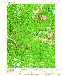
~ Mt Mc Loughlin OR topo map, 1:62500 scale, 15 X 15 Minute, Historical, 1955, updated 1962
Mt Mc Loughlin, Oregon, USGS topographic map dated 1955.
Includes geographic coordinates (latitude and longitude). This topographic map is suitable for hiking, camping, and exploring, or framing it as a wall map.
Printed on-demand using high resolution imagery, on heavy weight and acid free paper, or alternatively on a variety of synthetic materials.
Topos available on paper, Waterproof, Poly, or Tyvek. Usually shipping rolled, unless combined with other folded maps in one order.
- Product Number: USGS-5545140
- Free digital map download (high-resolution, GeoPDF): Mt Mc Loughlin, Oregon (file size: 10 MB)
- Map Size: please refer to the dimensions of the GeoPDF map above
- Weight (paper map): ca. 55 grams
- Map Type: POD USGS Topographic Map
- Map Series: HTMC
- Map Verison: Historical
- Cell ID: 58071
- Scan ID: 282750
- Imprint Year: 1962
- Woodland Tint: Yes
- Aerial Photo Year: 1953
- Field Check Year: 1955
- Datum: NAD27
- Map Projection: Polyconic
- Map published by United States Geological Survey
- Map Language: English
- Scanner Resolution: 600 dpi
- Map Cell Name: Mount McLoughlin
- Grid size: 15 X 15 Minute
- Date on map: 1955
- Map Scale: 1:62500
- Geographical region: Oregon, United States
Neighboring Maps:
All neighboring USGS topo maps are available for sale online at a variety of scales.
Spatial coverage:
Topo map Mt Mc Loughlin, Oregon, covers the geographical area associated the following places:
- Hunts Post Office (historical) - Service Glades - Buck Point Lookout - Brown Mountain Trail - Dead Indian Soda Springs - Dead Indian Mountain - Cougar Spring - Lilyglen Post Office (historical) - Stanley Ranch (historical) - Crater Trail - Freye Lake - Dry Creek Camp - Grizzly Creek Jackson County Boat Ramp - Bear Pan Spring - Paradise (historical) - Indian Glade - Squaw Tip Trail (historical) - Porcupine Spring - Willow Creek Resort - Twin Ponds Trail - North Squaw Tip - West Branch Willow Creek - Owens Spring - Mount McLoughlin Trail - Elder Ranch - City of Medford Watershed - Twin Ponds Camp - Willow Prairie Recreation Site - Willow Creek Dam - Cox Creek - Elder Spring - Indian Creek - Brown Mountain - Dogwood Spring - Swamp Creek - Buck Point - Deadwood - Orris Pond - Fourmile Lake - Robinson Prairie - Swastika Post Office (historical) - Cox Butte - Gawa Church Camp - Deadwood Prairie - Calamity Forest Camp (historical) - Twin Ponds - Whiskey Spring Recreation Site - Grizzly Canyon - Swan Creek - Dead Indian Creek - Cook Burn - Camp Seventy-six - Buck Point Trail - Iron Spring Gulch - Fish Lake - Mount McLoughlin - Cold Springs - Grizzly Creek Dam Number 2 - Beaver Dam Recreation Site - Bieberstedt Creek - Daley Creek Recreation Site - Whiskey Spring - Doe Point Recreation Site - Short Creek Prairie - Skeeters Swamp - Mosquito Camp - Big Draw Creek - Danley Creek Canal - Pole Bridge Creek - Summit Lake - Ellick Creek - Bieberstedt Butte - South Squaw Tip - Medford Watershed - Moon Prairie Guard Station - Lilly Glen County Campground - Walch Creek - Owens Ranch - Bieberstedt Trail - Doe Point - Robinson Butte - Summit Sno-Park - Dead End Trail - South Fork Bieberstedt Creek - Little Elk Prairie - North Fork Recreation Site - Brush Mountain - Willow Lake Jackson County Boat Ramp - Big Elk Guard Station - High Lakes Pass - South Fork Canal - Horse Creek - Daley Creek Dam - Deadwood Junction - Shake Camp - Beaver Dam Creek - Bourbon Spring - Lilyglen (historical) - Railroad Prairie - Fish Lake Resort Marina
- Map Area ID: AREA42.542.25-122.5-122.25
- Northwest corner Lat/Long code: USGSNW42.5-122.5
- Northeast corner Lat/Long code: USGSNE42.5-122.25
- Southwest corner Lat/Long code: USGSSW42.25-122.5
- Southeast corner Lat/Long code: USGSSE42.25-122.25
- Northern map edge Latitude: 42.5
- Southern map edge Latitude: 42.25
- Western map edge Longitude: -122.5
- Eastern map edge Longitude: -122.25


