
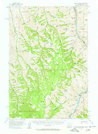
~ Kernan Point OR topo map, 1:62500 scale, 15 X 15 Minute, Historical, 1954, updated 1958
Kernan Point, Oregon, USGS topographic map dated 1954.
Includes geographic coordinates (latitude and longitude). This topographic map is suitable for hiking, camping, and exploring, or framing it as a wall map.
Printed on-demand using high resolution imagery, on heavy weight and acid free paper, or alternatively on a variety of synthetic materials.
Topos available on paper, Waterproof, Poly, or Tyvek. Usually shipping rolled, unless combined with other folded maps in one order.
- Product Number: USGS-5544910
- Free digital map download (high-resolution, GeoPDF): Kernan Point, Oregon (file size: 9 MB)
- Map Size: please refer to the dimensions of the GeoPDF map above
- Weight (paper map): ca. 55 grams
- Map Type: POD USGS Topographic Map
- Map Series: HTMC
- Map Verison: Historical
- Cell ID: 56117
- Scan ID: 282624
- Imprint Year: 1958
- Woodland Tint: Yes
- Visual Version Number: 2
- Aerial Photo Year: 1953
- Field Check Year: 1954
- Datum: NAD27
- Map Projection: Polyconic
- Map published by United States Geological Survey
- Map Language: English
- Scanner Resolution: 600 dpi
- Map Cell Name: Kernan Point
- Grid size: 15 X 15 Minute
- Date on map: 1954
- Map Scale: 1:62500
- Geographical region: Oregon, United States
Neighboring Maps:
All neighboring USGS topo maps are available for sale online at a variety of scales.
Spatial coverage:
Topo map Kernan Point, Oregon, covers the geographical area associated the following places:
- Winters Gulch - Windy Ridge - Somers Creek Rapids - Dry Gulch - Last Chance Creek - Hays Gulch - Somers Point - Teaser Creek - Salt Creek Rapids - China Bar Rapids - Haas Horse Troughs (historical) - Git'em Creek - Haas Ridge - Mormon Prong - Highrange Rapids - Rhodes Creek - Cougar Creek - Thorny Creek - Highrange Creek - Grimes Creek - North Temperance Creek - Roy Canyon - Fingerboard Gulch - Windy Hell Canyon - Sleepy Creek - Salt Creek Cabin (historical) - Medicine Creek - Tryon Creek - Sour Apple Flat - Camp Creek - McCarty Creek - Mormon Spring - Lookout Creek - Jones Creek - Bald Knob - Big Canyon Creek - Lookout Creek Rapids - Rowley Gulch - Rhodes Creek Ranch - Buckaroo Gulch - Bull Creek - Mormon Flat - Lord Flat Airport (historical) - Somers Creek - Low Saddle - Kernan Point - Salt Creek - Wisenor Place - Slaughter Gulch - Hominy Creek Rapids - Snake National Wild River - Brockman Ranch - Jakey Ridge - Dry Gulch - Ninemile Saddle - Temperance Creek - Hominy Creek - Kneeland Place - Davis Creek Rapids - Wing Ridge - Wing Creek - Fingerboard Saddle - Winters Spring - Winsor Place - Quartz Creek - West Fork Somer Creek - Two Corral Creek - Hominy Saddle - Smooth Gulch - Dorrance Cow Camp - Somers Ranch - Davis Creek - Slaughter Gulch Rapids - Myers Creek - Little Bar Rapids - Cache Canyon - Tryon Creek Ranch - High Bar - Long Prong - High Bar Rapids - Rheumatiz Gulch - Butcherknife Creek - Litch Ranch - Cottonwood Rapids - Suicide Point - Dad Spring - Copper Creek Lodge - Lonepine Creek - Sleepy Ridge - Cove Creek - Big Bar - Caribou Creek - Hangover Creek - Hells Canyon National Recreation Area - Grassy Knoll - Schleur Gulch - Duncan Gulch - Hog Creek - Getta Creek - Hutton Gulch
- Map Area ID: AREA45.7545.5-116.75-116.5
- Northwest corner Lat/Long code: USGSNW45.75-116.75
- Northeast corner Lat/Long code: USGSNE45.75-116.5
- Southwest corner Lat/Long code: USGSSW45.5-116.75
- Southeast corner Lat/Long code: USGSSE45.5-116.5
- Northern map edge Latitude: 45.75
- Southern map edge Latitude: 45.5
- Western map edge Longitude: -116.75
- Eastern map edge Longitude: -116.5


