
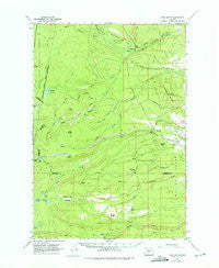
~ Fort Butte OR topo map, 1:62500 scale, 15 X 15 Minute, Historical, 1961, updated 1975
Fort Butte, Oregon, USGS topographic map dated 1961.
Includes geographic coordinates (latitude and longitude). This topographic map is suitable for hiking, camping, and exploring, or framing it as a wall map.
Printed on-demand using high resolution imagery, on heavy weight and acid free paper, or alternatively on a variety of synthetic materials.
Topos available on paper, Waterproof, Poly, or Tyvek. Usually shipping rolled, unless combined with other folded maps in one order.
- Product Number: USGS-5544696
- Free digital map download (high-resolution, GeoPDF): Fort Butte, Oregon (file size: 8 MB)
- Map Size: please refer to the dimensions of the GeoPDF map above
- Weight (paper map): ca. 55 grams
- Map Type: POD USGS Topographic Map
- Map Series: HTMC
- Map Verison: Historical
- Cell ID: 54257
- Scan ID: 282504
- Imprint Year: 1975
- Woodland Tint: Yes
- Aerial Photo Year: 1958
- Field Check Year: 1961
- Datum: NAD27
- Map Projection: Polyconic
- Map published by United States Geological Survey
- Map Language: English
- Scanner Resolution: 600 dpi
- Map Cell Name: Fort Butte
- Grid size: 15 X 15 Minute
- Date on map: 1961
- Map Scale: 1:62500
- Geographical region: Oregon, United States
Neighboring Maps:
All neighboring USGS topo maps are available for sale online at a variety of scales.
Spatial coverage:
Topo map Fort Butte, Oregon, covers the geographical area associated the following places:
- North Butte - South Fork Boulder Creek - Camas Prairie Trail - Camp One Trail - Schoolie Pasture Ranger Station - Warm Springs - Sawmill Butte - Warm Springs Meadows - Trout Lake Campground - Schoolie Pasture - Island Lake - Cedar Meadow - Lookout Butte - Blue Lake Camas Prairie Trail - Bunchgrass Creek - Fort Butte - Old Mill Camp - Cinder Cone - Trout Lake - Sidwalter Buttes - Cedar Creek - North Fork Cedar Creek - Boulder Lake - Nellie Spring - Francis Lake - Blue Lake - Camas Prairie - Peters Pasture - North Fork Boulder Creek - Bypass Trail - Badger Butte - Big Spring - North Butte - South Fork Warm Springs River - Owl Spring - Boulder Creek Meadows - Mill Creek Lateral - Cedar Butte
- Map Area ID: AREA4544.75-121.75-121.5
- Northwest corner Lat/Long code: USGSNW45-121.75
- Northeast corner Lat/Long code: USGSNE45-121.5
- Southwest corner Lat/Long code: USGSSW44.75-121.75
- Southeast corner Lat/Long code: USGSSE44.75-121.5
- Northern map edge Latitude: 45
- Southern map edge Latitude: 44.75
- Western map edge Longitude: -121.75
- Eastern map edge Longitude: -121.5


