
~ Desolation Butte OR topo map, 1:62500 scale, 15 X 15 Minute, Historical, 1951, updated 1963
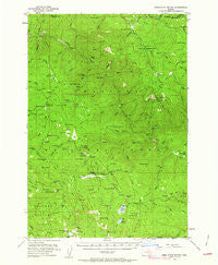
Desolation Butte, Oregon, USGS topographic map dated 1951.
Includes geographic coordinates (latitude and longitude). This topographic map is suitable for hiking, camping, and exploring, or framing it as a wall map.
Printed on-demand using high resolution imagery, on heavy weight and acid free paper, or alternatively on a variety of synthetic materials.
Topos available on paper, Waterproof, Poly, or Tyvek. Usually shipping rolled, unless combined with other folded maps in one order.
- Product Number: USGS-5544520
- Free digital map download (high-resolution, GeoPDF): Desolation Butte, Oregon (file size: 9 MB)
- Map Size: please refer to the dimensions of the GeoPDF map above
- Weight (paper map): ca. 55 grams
- Map Type: POD USGS Topographic Map
- Map Series: HTMC
- Map Verison: Historical
- Cell ID: 53382
- Scan ID: 282415
- Imprint Year: 1963
- Woodland Tint: Yes
- Aerial Photo Year: 1950
- Field Check Year: 1951
- Datum: NAD27
- Map Projection: Polyconic
- Map published by United States Geological Survey
- Map Language: English
- Scanner Resolution: 600 dpi
- Map Cell Name: Desolation Butte
- Grid size: 15 X 15 Minute
- Date on map: 1951
- Map Scale: 1:62500
- Geographical region: Oregon, United States
Neighboring Maps:
All neighboring USGS topo maps are available for sale online at a variety of scales.
Spatial coverage:
Topo map Desolation Butte, Oregon, covers the geographical area associated the following places:
- Sheep Rock - White Creek - Rabbit Creek - Spruce Log Trail - Olive Lake Dam - Olive Lake - South Fork Desolation Creek - Cougar Creek - Gutridge Mine - Log Table Camp - Donaldson Rock - Fitzwater Gulch - Martin Creek - Desolation Meadows - Kelsay Meadows - Oregon Gulch - Winom Butte - Rabbit Butte - Anderson Gulch - Cold Spring Trail - Cold Spring Camp - Oriental Creek Recreation Site - Lake Creek Trail - Corral Creek - Meadow Creek Driveway Trail - Indian Rock Trail - Pothole Camp - Lower Cougar Camp - Squaw Creek - Pole Creek - Donaldson Mine - Lost Lake - East Fork of North Fork Desolation Creek - Glade Creek - Forks Guard Station - Mutton Camp - Trout Meadows Trail - Wolsey Creek - China Meadow - Faulkner Gulch - Jumpoff Joe Lake - Desolation Guard Station - Lost Lake Trail - Lick Creek - Ben Camp - South Fork Meadow Creek - Olive Lake Boat Launch - Big Creek - Kelsay Spring - Indian Creek - Silver Hill Trail - Miners Cabin - Sunset Spring - Simpson Creek - Bear Gulch - Lost Camp Trail - Silver Creek - Meadow Camp - Welch Creek Trail - Kelsay Butte - Wagner Gulch Trail - West Fork of North Fork Desolation Creek - Bismark Creek - Saddle Camp - Granite Creek - Dixson Bar - Moon Meadow - Desolation Butte - Meadow Creek - Silver Butte - Corral Creek Trail - Glade Creek Trail - Lost Camp - Upper Reservoir - Jumpoff Joe Peak - Lower Howard Camp - Ryder Creek - Ranger Station Camp (historical) - Cold Spring - Skinner Mine - Battle Creek Camp - Sponge Creek - Sheep Creek - Silver Butte Trail - Lost Creek - Dry Gulch - Cabin Creek - Battle Creek Trail - Raspberry Creek - Wind Rock - Paradise Trail - Indian Rock - Olive Lake Camp - Basin Creek - Olive Lake Recreation Site - Rock Spring Camp - Oregon Gulch Camp - Lost Horse Meadow - Lake Creek - Lost Creek Camp
- Map Area ID: AREA4544.75-118.75-118.5
- Northwest corner Lat/Long code: USGSNW45-118.75
- Northeast corner Lat/Long code: USGSNE45-118.5
- Southwest corner Lat/Long code: USGSSW44.75-118.75
- Southeast corner Lat/Long code: USGSSE44.75-118.5
- Northern map edge Latitude: 45
- Southern map edge Latitude: 44.75
- Western map edge Longitude: -118.75
- Eastern map edge Longitude: -118.5


