
~ Chucksney Mtn OR topo map, 1:62500 scale, 15 X 15 Minute, Historical, 1955, updated 1958
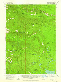
Chucksney Mtn, Oregon, USGS topographic map dated 1955.
Includes geographic coordinates (latitude and longitude). This topographic map is suitable for hiking, camping, and exploring, or framing it as a wall map.
Printed on-demand using high resolution imagery, on heavy weight and acid free paper, or alternatively on a variety of synthetic materials.
Topos available on paper, Waterproof, Poly, or Tyvek. Usually shipping rolled, unless combined with other folded maps in one order.
- Product Number: USGS-5544402
- Free digital map download (high-resolution, GeoPDF): Chucksney Mtn, Oregon (file size: 9 MB)
- Map Size: please refer to the dimensions of the GeoPDF map above
- Weight (paper map): ca. 55 grams
- Map Type: POD USGS Topographic Map
- Map Series: HTMC
- Map Verison: Historical
- Cell ID: 52572
- Scan ID: 282339
- Imprint Year: 1958
- Woodland Tint: Yes
- Aerial Photo Year: 1954
- Field Check Year: 1955
- Datum: NAD27
- Map Projection: Polyconic
- Map published by United States Geological Survey
- Map Language: English
- Scanner Resolution: 600 dpi
- Map Cell Name: Chucksney Mountain
- Grid size: 15 X 15 Minute
- Date on map: 1955
- Map Scale: 1:62500
- Geographical region: Oregon, United States
Neighboring Maps:
All neighboring USGS topo maps are available for sale online at a variety of scales.
Spatial coverage:
Topo map Chucksney Mtn, Oregon, covers the geographical area associated the following places:
- Taylor Burn Recreation Site - Erma Bell Lakes - Mule Creek - Waldo Mountain - Box Canyon - Ranger Creek - Taylor Burn - Curley Creek - Tiny Creek - Blair Lake Trail - Skookum Creek Recreation Site - Otter Lake - Reilly Meadows - Salt Rock Prairie - Williams Lake - Rebel Rock Lookout - Brock Creek - Boomer Creek - Emma Lake - Hiyu Ridge - Middle Erma Bell Lake - Blair Meadows - Long Prairie - Brittany Lake - Moolack Mountain - Moolack Creek - Wapiti Creek - Moolack Flat - Winnie Prairie - Lowell Mountain - Landis Cabin - Dutch Oven Forest Camp - Winchester Forest Camp (historical) - Upper Quinn Lake - Lower Eddeeleo Lake - Blair Lake Recreation Site - Delate Creek - Hiyu Trail - Ernie Lake - Rebel Rock - East Quinn Lake - Whig Lake - Bull Creek - Winchester Lake - North Torrey Lake - Roaring River - Glade Creek - Salmon Lakes - Small Creek - Gosling Lakes - Elk Creek - Moolack Lake - Waldo Meadows - Fisher Creek - Cascade Creek - Chucksney Creek - McBee Creek - Spring Prairie - Blair Lake - Gander Lake - North Waldo Boat Ramp - Twin Springs Campground (historical) - Eddeeleo Lakes - Swan Lake - Augusta Creek - Beal Prairie - Upper Eddeeleo Lake - Spring Meadow - Devils Lake - Koch Creek - Lake Kiwa - Blue Creek - Upper Rigdon Lake - Lower Erma Bell Lake - Minute Creek - Dans Lake - Starr Creek - Rigdon Butte - Cervus Lake - Upper Erma Bell Lake - Conim Lake - North Prairie - Helen Lake - Lower Salmon Lake - Alice Creek - North Waldo Recreation Site - Eastern Brook Lake - Pocher Creek - Triangle Creek - Taylor Burn Guard Station - Grasshopper Mountain - Frissell Crossing Campground Boat Ramp - Fir Creek - Roaring River Group Camp - Pitch Creek - Captain Prairie - Fisher Prairie - Skookum Lake - Mud Lake - Grasshopper Creek
- Map Area ID: AREA4443.75-122.25-122
- Northwest corner Lat/Long code: USGSNW44-122.25
- Northeast corner Lat/Long code: USGSNE44-122
- Southwest corner Lat/Long code: USGSSW43.75-122.25
- Southeast corner Lat/Long code: USGSSE43.75-122
- Northern map edge Latitude: 44
- Southern map edge Latitude: 43.75
- Western map edge Longitude: -122.25
- Eastern map edge Longitude: -122


