
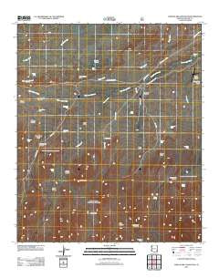
~ Shingle Mill Mountain AZ topo map, 1:24000 scale, 7.5 X 7.5 Minute, Historical, 2011
Shingle Mill Mountain, Arizona, USGS topographic map dated 2011.
Includes geographic coordinates (latitude and longitude). This topographic map is suitable for hiking, camping, and exploring, or framing it as a wall map.
Printed on-demand using high resolution imagery, on heavy weight and acid free paper, or alternatively on a variety of synthetic materials.
Topos available on paper, Waterproof, Poly, or Tyvek. Usually shipping rolled, unless combined with other folded maps in one order.
- Product Number: USGS-5544088
- Free digital map download (high-resolution, GeoPDF): Shingle Mill Mountain, Arizona (file size: 24 MB)
- Map Size: please refer to the dimensions of the GeoPDF map above
- Weight (paper map): ca. 55 grams
- Map Type: POD USGS Topographic Map
- Map Series: US Topo
- Map Verison: Historical
- Cell ID: 41099
- Datum: North American Datum of 1983
- Map Projection: Transverse Mercator
- Map Cell Name: Shingle Mill Mountain
- Grid size: 7.5 X 7.5 Minute
- Date on map: 2011
- Map Scale: 1:24000
- Geographical region: Arizona, United States
Neighboring Maps:
All neighboring USGS topo maps are available for sale online at a variety of scales.
Spatial coverage:
Topo map Shingle Mill Mountain, Arizona, covers the geographical area associated the following places:
- Bear Springs Knoll - Bear Springs Wash - Tramline Tank - Bear Springs - Nuttall Canyon - Coyote Knoll - Chatfield Pond - Bigler Ponds - Seven Cross Tank - Green Spring - Mexican Tank - Hulda Gap Corral - Browns Tank - Lamb Hotel - Carter Canyon - Pima Well - Bryce Knoll - Lefthand Canyon - Lamb Tank - Middle Wash - Squaw Tank - Goat Hill - Hells Hole Creek - Mexican Canyon - Stowe Knoll - Shingle Mill Mountain - Sand Tank - Ringcone Tank - Blair Canyon - Webb One Tank - Flying J Ranch Airport - North Taylor Canyon - Merrill Wash - Stockpond Tank - Bear Basin - Dead Steer Mesa - Shingle Mill Mesa Thirty Five Trail - Dickey Spring - Coyote Tank - Cottonwood Creek - Hells Hole Canyon - Carter Tank - Wide Mouth Canyon - Sand Wash - Carter Canyon Number Thirty four Trail - Tunnel Canyon - Shingle Mill Canyon
- Map Area ID: AREA32.87532.75-110-109.875
- Northwest corner Lat/Long code: USGSNW32.875-110
- Northeast corner Lat/Long code: USGSNE32.875-109.875
- Southwest corner Lat/Long code: USGSSW32.75-110
- Southeast corner Lat/Long code: USGSSE32.75-109.875
- Northern map edge Latitude: 32.875
- Southern map edge Latitude: 32.75
- Western map edge Longitude: -110
- Eastern map edge Longitude: -109.875


