
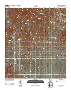
~ Batamote Hills AZ topo map, 1:24000 scale, 7.5 X 7.5 Minute, Historical, 2011
Batamote Hills, Arizona, USGS topographic map dated 2011.
Includes geographic coordinates (latitude and longitude). This topographic map is suitable for hiking, camping, and exploring, or framing it as a wall map.
Printed on-demand using high resolution imagery, on heavy weight and acid free paper, or alternatively on a variety of synthetic materials.
Topos available on paper, Waterproof, Poly, or Tyvek. Usually shipping rolled, unless combined with other folded maps in one order.
- Product Number: USGS-5543830
- Free digital map download (high-resolution, GeoPDF): Batamote Hills, Arizona (file size: 21 MB)
- Map Size: please refer to the dimensions of the GeoPDF map above
- Weight (paper map): ca. 55 grams
- Map Type: POD USGS Topographic Map
- Map Series: US Topo
- Map Verison: Historical
- Cell ID: 2600
- Datum: North American Datum of 1983
- Map Projection: Transverse Mercator
- Map Cell Name: Batamote Hills
- Grid size: 7.5 X 7.5 Minute
- Date on map: 2011
- Map Scale: 1:24000
- Geographical region: Arizona, United States
Neighboring Maps:
All neighboring USGS topo maps are available for sale online at a variety of scales.
Spatial coverage:
Topo map Batamote Hills, Arizona, covers the geographical area associated the following places:
- Twin Tanks - Escondido Well - Batamote Tank - Twin Ponds - McGee Well - Ritchey Peak - Champurrado Tank - Sierrita Well - Batamote Hills - Esperanza Pit - Champurrado Wash Tank - Ox Frame Canyon - Blackhawk Mine - Tinaja Well - Lobo Peak - Tios Tank - Baños Well - Tinaja Hills - Chimney Tank - Lobo Well - Harris Ranch - Horse Tank - Champurrado Well - Mesquite Tanks - Sierrita Mine East Pit - High Tank - Tank Canyon - Ridge Tank - Batamote Ranch - Homestead Tank - Batamote Pasture Tank - Tinaja Tank - Duval Mine - Kenny Well - Adobe House Tank - Canyon Tank - Thomas Tank - Horse Pasture Hill - George Tank - Black Hawk Tank - South Tank - Kemper Tank - Pila Cerro Well - Adobe House Well - Corner Tank - Red Boy Peak - Tinaja Ranch - Cowboy Tank - Kidoo Tank - Dons Tank - Tinaja Peak - Batamote Well
- Map Area ID: AREA31.87531.75-111.25-111.125
- Northwest corner Lat/Long code: USGSNW31.875-111.25
- Northeast corner Lat/Long code: USGSNE31.875-111.125
- Southwest corner Lat/Long code: USGSSW31.75-111.25
- Southeast corner Lat/Long code: USGSSE31.75-111.125
- Northern map edge Latitude: 31.875
- Southern map edge Latitude: 31.75
- Western map edge Longitude: -111.25
- Eastern map edge Longitude: -111.125


