
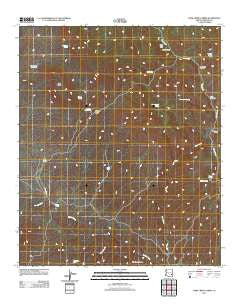
~ Park Creek Cabins AZ topo map, 1:24000 scale, 7.5 X 7.5 Minute, Historical, 2011
Park Creek Cabins, Arizona, USGS topographic map dated 2011.
Includes geographic coordinates (latitude and longitude). This topographic map is suitable for hiking, camping, and exploring, or framing it as a wall map.
Printed on-demand using high resolution imagery, on heavy weight and acid free paper, or alternatively on a variety of synthetic materials.
Topos available on paper, Waterproof, Poly, or Tyvek. Usually shipping rolled, unless combined with other folded maps in one order.
- Product Number: USGS-5543408
- Free digital map download (high-resolution, GeoPDF): Park Creek Cabins, Arizona (file size: 22 MB)
- Map Size: please refer to the dimensions of the GeoPDF map above
- Weight (paper map): ca. 55 grams
- Map Type: POD USGS Topographic Map
- Map Series: US Topo
- Map Verison: Historical
- Cell ID: 34218
- Datum: North American Datum of 1983
- Map Projection: Transverse Mercator
- Map Cell Name: Park Creek Cabins
- Grid size: 7.5 X 7.5 Minute
- Date on map: 2011
- Map Scale: 1:24000
- Geographical region: Arizona, United States
Neighboring Maps:
All neighboring USGS topo maps are available for sale online at a variety of scales.
Spatial coverage:
Topo map Park Creek Cabins, Arizona, covers the geographical area associated the following places:
- Oak Grove Tank - Black Mesa - Jesse Tank - Deadman Canyon - Red Box Corral - Mockingbird Spring - Turkey Spring Corral - Mescal Spring - Skeleton Tank - Whiskey Ridge Tank - Rose Garden Spring - Webster Spring - Keays Tank - Bonita Well - Rainbow Well - One V Well - Cold Spring - Red Seep Spring - Park Creek Cabins - Maverick Canyon - George Well - Rabbit Trap Corral - Whiskey Well - Whiskey Ridge - Cowboy Tank - Maverick Canyon Corral - Bryce Horse Camp Tank
- Map Area ID: AREA33.2533.125-109.75-109.625
- Northwest corner Lat/Long code: USGSNW33.25-109.75
- Northeast corner Lat/Long code: USGSNE33.25-109.625
- Southwest corner Lat/Long code: USGSSW33.125-109.75
- Southeast corner Lat/Long code: USGSSE33.125-109.625
- Northern map edge Latitude: 33.25
- Southern map edge Latitude: 33.125
- Western map edge Longitude: -109.75
- Eastern map edge Longitude: -109.625


