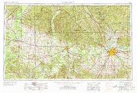
~ Montgomery AL topo map, 1:250000 scale, 1 X 2 Degree, Historical, 1953, updated 1978
Montgomery, Alabama, USGS topographic map dated 1953.
Includes geographic coordinates (latitude and longitude). This topographic map is suitable for hiking, camping, and exploring, or framing it as a wall map.
Printed on-demand using high resolution imagery, on heavy weight and acid free paper, or alternatively on a variety of synthetic materials.
Topos available on paper, Waterproof, Poly, or Tyvek. Usually shipping rolled, unless combined with other folded maps in one order.
- Product Number: USGS-5542909
- Free digital map download (high-resolution, GeoPDF): Montgomery, Alabama (file size: 23 MB)
- Map Size: please refer to the dimensions of the GeoPDF map above
- Weight (paper map): ca. 55 grams
- Map Type: POD USGS Topographic Map
- Map Series: HTMC
- Map Verison: Historical
- Cell ID: 68918
- Scan ID: 305928
- Imprint Year: 1978
- Woodland Tint: Yes
- Aerial Photo Year: 1953
- Edit Year: 1969
- Datum: Unstated
- Map Projection: Transverse Mercator
- Map published by: Military, Other
- Map Language: English
- Scanner Resolution: 600 dpi
- Map Cell Name: Montgomery
- Grid size: 1 X 2 Degree
- Date on map: 1953
- Map Scale: 1:250000
- Geographical region: Alabama, United States
Neighboring Maps:
All neighboring USGS topo maps are available for sale online at a variety of scales.
Spatial coverage:
Topo map Montgomery, Alabama, covers the geographical area associated the following places:
- Falakto - Claud - Cotton - Bethel - Potter - Boykin - Thorsby - Crewsville - Braggs - Pin Hook - Trickem - Aimwell - Arlington - Polk - Trinity - Pyron - Collirene - Mertz - Cloverdale - Ironville - Lily Grove (historical) - Marengo - Harper Hill - North Pass - Overton Heights - Brookwood Estates - Whitsitt - Tharin - Union Grove - Pintlala - Safford - Olde Acres - Dominick - Cecil - Lyon (historical) - Mosswood - Blue Ridge - Prairie - Eastern Meadows - Rosemond Estates - Midway - Beth Grove (historical) - Tilden - West Centreville - McGehee Estates - Oak Grove - Sunset Mill Village - Young Place - Deatsville - Keyno - Swink - Poseys Crossroads - Willowbrook - Shiloh - Miller - Pletcher - Furman - Canaan - Billingsley - Bell Meadows - Providence - Tyson - Dollar - Mulberry - Mount Nebo - Old Bingham - Marshall - Independence - Brantley - Garden Square - Mathews - Glendale Acres - Dannley Pines - Dawsons - Woodland Heights - Gordonsville - Carters Hill - Dixons Mills - Georgetown - Old Town - Saint Clair - Wedgeworth - Brookview Manor - Allison - Arcola - McCorkle (historical) - Jefferson - Schley - Darrah - Isabella - Sardis - Pleasant Grove - Mountain View Estates - Thomas Mill - Speed - Mosses - Steep Creek - Boiling Springs - Rolling Acres - Highland
- Map Area ID: AREA3332-88-86
- Northwest corner Lat/Long code: USGSNW33-88
- Northeast corner Lat/Long code: USGSNE33-86
- Southwest corner Lat/Long code: USGSSW32-88
- Southeast corner Lat/Long code: USGSSE32-86
- Northern map edge Latitude: 33
- Southern map edge Latitude: 32
- Western map edge Longitude: -88
- Eastern map edge Longitude: -86

