
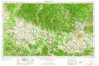
~ Montgomery AL topo map, 1:250000 scale, 1 X 2 Degree, Historical, 1953, updated 1964
Montgomery, Alabama, USGS topographic map dated 1953.
Includes geographic coordinates (latitude and longitude). This topographic map is suitable for hiking, camping, and exploring, or framing it as a wall map.
Printed on-demand using high resolution imagery, on heavy weight and acid free paper, or alternatively on a variety of synthetic materials.
Topos available on paper, Waterproof, Poly, or Tyvek. Usually shipping rolled, unless combined with other folded maps in one order.
- Product Number: USGS-5542907
- Free digital map download (high-resolution, GeoPDF): Montgomery, Alabama (file size: 23 MB)
- Map Size: please refer to the dimensions of the GeoPDF map above
- Weight (paper map): ca. 55 grams
- Map Type: POD USGS Topographic Map
- Map Series: HTMC
- Map Verison: Historical
- Cell ID: 68918
- Scan ID: 305926
- Imprint Year: 1964
- Woodland Tint: Yes
- Aerial Photo Year: 1952
- Edit Year: 1964
- Field Check Year: 1953
- Datum: Unstated
- Map Projection: Transverse Mercator
- Map published by United States Army Corps of Engineers
- Map published by United States Army
- Map Language: English
- Scanner Resolution: 600 dpi
- Map Cell Name: Montgomery
- Grid size: 1 X 2 Degree
- Date on map: 1953
- Map Scale: 1:250000
- Geographical region: Alabama, United States
Neighboring Maps:
All neighboring USGS topo maps are available for sale online at a variety of scales.
Spatial coverage:
Topo map Montgomery, Alabama, covers the geographical area associated the following places:
- Live Oaks - Gastonburg - New Bingham - Davis Crossroads - Sunset Park Estates - Gibson - Old Vernon (historical) - Montgomery East - Verbena - Midway - Randolph - Donald - Wiley - Harrogate Springs - Lamison - Augustin - Guinea - Browns - Powelldale - Strata - Ellawhite - Collirene - Alberta - Perryville - Rolling Acres - Cottage Grove - Crenshaw (historical) - Calhoun - Foxwood - Booth - Haynes - Griffins (historical) - Sunshine Village - Bell Meadows - Village West - Surginer - Brewer Estates - McDowell - Edsons - Gordonville - Fays - Pletcher - Greensboro - Vineland - Cherokee Estates - Mount Meigs - Evansville - Braggville - Saint Clair - Sugarville - Chisholm - Kellyton - Magnolia - Union - Abercrombie - Trinity - Westbrook - Collins Chapel - Grove Hill - Spocari - Country Estates - Gilmore Quarters - Hillwood - Hill Top - Ellards - Cedarville - Gallion - Tombigbee (historical) - Sweet Water - Lynndale - Highland Village - Merry - Wallsboro - Glendale Acres - Capitol Heights - Schley - Monterey Park - Braggs - Central - Mount Sinai - Adler - Halcyon - Woodley East Estates - Willowbrook - Linden - Fishpond - Sprott - Brush Creek - Dawsons - Woodley Park - Oak Grove - Governors Estates - Heatherton Heights - Duff Settlement - Heiberger - Pine Level - Pentonville - Marion Junction - Gibbs Village - Nave
- Map Area ID: AREA3332-88-86
- Northwest corner Lat/Long code: USGSNW33-88
- Northeast corner Lat/Long code: USGSNE33-86
- Southwest corner Lat/Long code: USGSSW32-88
- Southeast corner Lat/Long code: USGSSE32-86
- Northern map edge Latitude: 33
- Southern map edge Latitude: 32
- Western map edge Longitude: -88
- Eastern map edge Longitude: -86


