
~ Mobile AL topo map, 1:250000 scale, 1 X 2 Degree, Historical, 1953, updated 1968
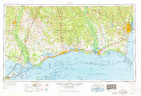
Mobile, Alabama, USGS topographic map dated 1953.
Includes geographic coordinates (latitude and longitude). This topographic map is suitable for hiking, camping, and exploring, or framing it as a wall map.
Printed on-demand using high resolution imagery, on heavy weight and acid free paper, or alternatively on a variety of synthetic materials.
Topos available on paper, Waterproof, Poly, or Tyvek. Usually shipping rolled, unless combined with other folded maps in one order.
- Product Number: USGS-5542891
- Free digital map download (high-resolution, GeoPDF): Mobile, Alabama (file size: 20 MB)
- Map Size: please refer to the dimensions of the GeoPDF map above
- Weight (paper map): ca. 55 grams
- Map Type: POD USGS Topographic Map
- Map Series: HTMC
- Map Verison: Historical
- Cell ID: 68917
- Scan ID: 305921
- Imprint Year: 1968
- Woodland Tint: Yes
- Edit Year: 1962
- Field Check Year: 1953
- Datum: Unstated
- Map Projection: Transverse Mercator
- Map published by United States Army Corps of Engineers
- Map published by United States Army
- Map Language: English
- Scanner Resolution: 600 dpi
- Map Cell Name: Mobile
- Grid size: 1 X 2 Degree
- Date on map: 1953
- Map Scale: 1:250000
- Geographical region: Alabama, United States
Neighboring Maps:
All neighboring USGS topo maps are available for sale online at a variety of scales.
Spatial coverage:
Topo map Mobile, Alabama, covers the geographical area associated the following places:
- Shady Grove Mobile Home Park - Colt - Bay Saint Louis - La Cresta Mobile Home Park - Katherine Hankins Trailer Park - Martin Bluff - Lake Village - Pine Run - Gibson Landing - Sawmill Pointe - Smithfield - Theodore - River Gardens - Maxie - El Monte - Marston (historical) - Myles Manor Trailer Park - Napoleon - Gainesville - Vestry - North Mobile - New Hope - Semmes Mobile Home Park - Bay Shore Mobile Court - Nelson - Timber Lake Estates - Princeton Woods - Aces Trailer Park - Rowlands - Southern Breeze Mobile Home Park - Robert Park - Santa Rosa - Orange Grove - Bill Herod Trailer Park - Agricola - Orchard - Pine Shadows - Twin Oaks Mobile Manor - De La Be Forrest Mobile Home Park - Bell Terre Acres - Skyland Park Estates - Plantation Square Estates Mobile Home Park - Bellwood - Latonia - The Palms Trailer Park - Biloxi - Kushla - Akka - Pascagoula River Estates - Fort Bayou (historical) - Hickory - Magnolia Heights - Cottage Hill - Ozone Acres - Rolling Hills Mobile Estates - Ford - Donovan (historical) - New Country Club - Pecan Lane Mobile Home Park - Grand Bay - Scenic Hills - Tyler - Oakleigh Estates - Sherwood - Pearl River - Rawhide (historical) - Cedar Lake - North Biloxi - Ansley - Lott - Lincoln Park - Sea Pines Mobile Home Park - Mockingbird Hill Mobile Home Park - Wards Mobile Home Park - Pine Grove Mobile Home Park - Creekwood - Tabor Trailer Park - Shady Oak Mobile Park - Crestview - Watson Place Trailer Park - Lake Catherine - Edgewater Park - Ten Mile - Crossroads - Haaswood - Messer's Mobile Manor - Gulfside - Brookwood Estates - Davis Landing - White Sand - Holiday Acres - Longhorn Mobile Park - Town Mobile Home Park - Axis - Old Government Mobile Home Park - Bluff Creek Mobile Home Park - Country Club Estates - Missala - Forest Highlands - Mauvilla
- Map Area ID: AREA3130-90-88
- Northwest corner Lat/Long code: USGSNW31-90
- Northeast corner Lat/Long code: USGSNE31-88
- Southwest corner Lat/Long code: USGSSW30-90
- Southeast corner Lat/Long code: USGSSE30-88
- Northern map edge Latitude: 31
- Southern map edge Latitude: 30
- Western map edge Longitude: -90
- Eastern map edge Longitude: -88


