
~ Gadsden AL topo map, 1:250000 scale, 1 X 2 Degree, Historical, 1960, updated 1960
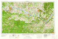
Gadsden, Alabama, USGS topographic map dated 1960.
Includes geographic coordinates (latitude and longitude). This topographic map is suitable for hiking, camping, and exploring, or framing it as a wall map.
Printed on-demand using high resolution imagery, on heavy weight and acid free paper, or alternatively on a variety of synthetic materials.
Topos available on paper, Waterproof, Poly, or Tyvek. Usually shipping rolled, unless combined with other folded maps in one order.
- Product Number: USGS-5542881
- Free digital map download (high-resolution, GeoPDF): Gadsden, Alabama (file size: 24 MB)
- Map Size: please refer to the dimensions of the GeoPDF map above
- Weight (paper map): ca. 55 grams
- Map Type: POD USGS Topographic Map
- Map Series: HTMC
- Map Verison: Historical
- Cell ID: 68793
- Scan ID: 305916
- Imprint Year: 1960
- Woodland Tint: Yes
- Field Check Year: 1956
- Datum: Unstated
- Map Projection: Transverse Mercator
- Map published by United States Army Corps of Engineers
- Map published by United States Army
- Map Language: English
- Scanner Resolution: 600 dpi
- Map Cell Name: Gadsden
- Grid size: 1 X 2 Degree
- Date on map: 1960
- Map Scale: 1:250000
- Geographical region: Alabama, United States
Neighboring Maps:
All neighboring USGS topo maps are available for sale online at a variety of scales.
Spatial coverage:
Topo map Gadsden, Alabama, covers the geographical area associated the following places:
- Houstontown - Dallas - Scenic View - Poplar Creek - Anderson Creek Subdivision - Joppa - Union Grove - Longleaf Estates - Pleasant Valley - Western Hills Estates - Denton (historical) - Harmony - Webb Addition - Atwood - Somerville - Rideout Village - Dry Cove (historical) - Royal - Anderson - Campbell Mill - Big Oak (historical) - Beechwood - C B S Trailer Court - Piney Grove - Hillsboro - Whitehouse - Leighton - Clift Acres - Chamblees Mill - Pettusville - Pinhook - Wilhites - Greenhill - Hickory Hills - Allens Crossroads - Hub (historical) - Oak Park - Three Forks - Joy - Union Hill - South Gate - Redbud - Winslow - The Cedars - Maple Hill - Piney Bend - Alexander Subdivision - Arley - Lindsay Lane - Dart - Anderson Creek Estates - Clemons Crossroad - Little Zion (historical) - Pittsburg - Green Cove Meadows - Bell Springs - Friendship (historical) - Barnett Chapel - Francisco - Lake Ida Heights - Whitehead - Tessner - Bellevue - Southern Pines - Melvin (historical) - Cavalry Hill - Canaan - Blountsville - Corbinville - Crane Hill - May Apple (historical) - Harris Station - Caddo Mobile Home Park - Byrd Springs - Clayborn - Masonville (historical) - Ridgway Mill - Walter - Glasgow Corner - Larissa (historical) - Birdie - Five Points - Kirbytown - Oak Grove - Indian Hills - Muscle Shoals - Mount Charron Estates - Mount Olive - Five Points - Cluttsville - Wynnville - Virginia Shores - Mount Tabor - Pine Haven Shores - Lynwood Gardens - Moulton - McLemore Point Subdivision - Ferns Quarter (historical) - Howelton - Preston
- Map Area ID: AREA3534-88-86
- Northwest corner Lat/Long code: USGSNW35-88
- Northeast corner Lat/Long code: USGSNE35-86
- Southwest corner Lat/Long code: USGSSW34-88
- Southeast corner Lat/Long code: USGSSE34-86
- Northern map edge Latitude: 35
- Southern map edge Latitude: 34
- Western map edge Longitude: -88
- Eastern map edge Longitude: -86


