
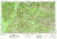
~ Andalusia AL topo map, 1:250000 scale, 1 X 2 Degree, Historical, 1953, updated 1973
Andalusia, Alabama, USGS topographic map dated 1953.
Includes geographic coordinates (latitude and longitude). This topographic map is suitable for hiking, camping, and exploring, or framing it as a wall map.
Printed on-demand using high resolution imagery, on heavy weight and acid free paper, or alternatively on a variety of synthetic materials.
Topos available on paper, Waterproof, Poly, or Tyvek. Usually shipping rolled, unless combined with other folded maps in one order.
- Product Number: USGS-5542857
- Free digital map download (high-resolution, GeoPDF): Andalusia, Alabama (file size: 25 MB)
- Map Size: please refer to the dimensions of the GeoPDF map above
- Weight (paper map): ca. 55 grams
- Map Type: POD USGS Topographic Map
- Map Series: HTMC
- Map Verison: Historical
- Cell ID: 68647
- Scan ID: 305904
- Imprint Year: 1973
- Woodland Tint: Yes
- Visual Version Number: 1
- Aerial Photo Year: 1952
- Edit Year: 1970
- Field Check Year: 1953
- Datum: Unstated
- Map Projection: Transverse Mercator
- Map published by: Military, Other
- Map Language: English
- Scanner Resolution: 600 dpi
- Map Cell Name: Andalusia
- Grid size: 1 X 2 Degree
- Date on map: 1953
- Map Scale: 1:250000
- Geographical region: Alabama, United States
Neighboring Maps:
All neighboring USGS topo maps are available for sale online at a variety of scales.
Spatial coverage:
Topo map Andalusia, Alabama, covers the geographical area associated the following places:
- Cohassett - Shady Grove - Gainestown - Alberton - Goshen - Midway - Social Town - Franklin - Samson - Beulah - Rhodes - Rome - Opine - Lee - Fountain - Allred - Moodys Crossroads - Mulberry - Mashville - Pleasant Hill - New Hope - Toddtown - Winn - Fort Deposit - Monroeville - Horn Hill - Choctaw Bluff - Grove Hill - Jay Villa - Hamburg - Hallsville - Fairview - Blacksher - Schuster - Pleasant Hill - Castleberry - Halso Mill - Rabb - Eliska - Beck - Janes Mill - Paul - Poarch - Weed Crossroad - Packards Bend - Georgiaville - Georgiana - Nellie - Salter - Midway - Rabun - Hixon - Tinela - Chapel Hill - Mount Gillis - Flomaton - Rock Creek - Lowery - Olustee - Rutledge - Mount Olive - Keith - Rock Springs - Sanford - Stanley Crossroads - Red Level - Claiborne - Welka - Ewing Farms - Lakeview (historical) - McCullough - Carson - Huxford - Marietta - Fairview - Youngblood - Commerce - Lottie - Duvall - Dry Forks - Brooklyn - Hacoda - Dozier - Green Street - Jack - Libertyville - Pine Level - Camden - Drewry - Asahel - Malta - Basin - Shacklesville - Perdue Hill - Panola - Herbert - Palmyra - Rutthven - Reddock Springs - Carlton
- Map Area ID: AREA3231-88-86
- Northwest corner Lat/Long code: USGSNW32-88
- Northeast corner Lat/Long code: USGSNE32-86
- Southwest corner Lat/Long code: USGSSW31-88
- Southeast corner Lat/Long code: USGSSE31-86
- Northern map edge Latitude: 32
- Southern map edge Latitude: 31
- Western map edge Longitude: -88
- Eastern map edge Longitude: -86


