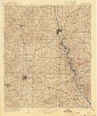
~ Opelika AL topo map, 1:125000 scale, 30 X 30 Minute, Historical, 1909, updated 1943
Opelika, Alabama, USGS topographic map dated 1909.
Includes geographic coordinates (latitude and longitude). This topographic map is suitable for hiking, camping, and exploring, or framing it as a wall map.
Printed on-demand using high resolution imagery, on heavy weight and acid free paper, or alternatively on a variety of synthetic materials.
Topos available on paper, Waterproof, Poly, or Tyvek. Usually shipping rolled, unless combined with other folded maps in one order.
- Product Number: USGS-5542777
- Free digital map download (high-resolution, GeoPDF): Opelika, Alabama (file size: 10 MB)
- Map Size: please refer to the dimensions of the GeoPDF map above
- Weight (paper map): ca. 55 grams
- Map Type: POD USGS Topographic Map
- Map Series: HTMC
- Map Verison: Historical
- Cell ID: 66251
- Scan ID: 305859
- Imprint Year: 1943
- Survey Year: 1907
- Datum: Unstated
- Map Projection: Polyconic
- Map published by United States Geological Survey
- Map Language: English
- Scanner Resolution: 600 dpi
- Map Cell Name: Opelika
- Grid size: 30 X 30 Minute
- Date on map: 1909
- Map Scale: 1:125000
- Geographical region: Alabama, United States
Neighboring Maps:
All neighboring USGS topo maps are available for sale online at a variety of scales.
Spatial coverage:
Topo map Opelika, Alabama, covers the geographical area associated the following places:
- Tillery Crossroad - University Estates - Oak Bowery - Meadows Crossroads - North Auburn - Maplecreek Hills - Alta Vista - Valley - Cannonville - Mechanicsville - Beauregard - New Hope - Lanett - Denson - Langdale - Indian Hills - Harwell Hills - Shotwell - Mount Jefferson - Oak Dale - Westside - Head Estates - Monterey Heights - Union Crossroads - Wards Mill - Huguley - Smiths Crossroad - Bent Creek - Woodland - Baughs Crossroads - Wright Crossroads - Shady Grove - Griffen Mill - Old Chimney - Jones Crossroads - Pioneer Village - Aubrey - Wacoochee Valley - Gray Hill - Prince Crossroads - North Gate - Green Island Hills - River View - Terrace Acres - Whipporwill Estates - Collingwood - Powledge - North Hills - Acton (historical) - Forestdale - Beans Mill - Woodland Hills - Gwen Mill - Spring Hill Heights - Chewacla - Mountain Hill - Crooked Creek - India Lakes - Federal Hills - Spring Villa - Lafayette - Mitchell Crossroads - White Plains - Old Atkinson Crossing - Glen Haven - Parkers Crossroads - Smiths Station - Pepperell - Wood Valley - Danway - Buffalo - Moffits Mill - Tanglewood - Pine Lake - North West Point - The Bottle - Tuckersburg - West Ridge - Cedar Brook - Nelson - McCulloh - Meadows Crossroads - Long Cane - Edgewood Forest - West Point - Glass - Cloverleaf - Twin Creeks - Colonial Acres - Sturkie - Hopewell - Oak Bowery Heights - Lake Forest Estates - Cottons Crossroads - Cary Woods - Lakewood - McGinty - Halawaka - Clines Crossroads - Smoke Rise
- Map Area ID: AREA3332.5-85.5-85
- Northwest corner Lat/Long code: USGSNW33-85.5
- Northeast corner Lat/Long code: USGSNE33-85
- Southwest corner Lat/Long code: USGSSW32.5-85.5
- Southeast corner Lat/Long code: USGSSE32.5-85
- Northern map edge Latitude: 33
- Southern map edge Latitude: 32.5
- Western map edge Longitude: -85.5
- Eastern map edge Longitude: -85

