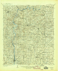
~ Dadeville AL topo map, 1:125000 scale, 30 X 30 Minute, Historical, 1906, updated 1945
Dadeville, Alabama, USGS topographic map dated 1906.
Includes geographic coordinates (latitude and longitude). This topographic map is suitable for hiking, camping, and exploring, or framing it as a wall map.
Printed on-demand using high resolution imagery, on heavy weight and acid free paper, or alternatively on a variety of synthetic materials.
Topos available on paper, Waterproof, Poly, or Tyvek. Usually shipping rolled, unless combined with other folded maps in one order.
- Product Number: USGS-5542721
- Free digital map download (high-resolution, GeoPDF): Dadeville, Alabama (file size: 10 MB)
- Map Size: please refer to the dimensions of the GeoPDF map above
- Weight (paper map): ca. 55 grams
- Map Type: POD USGS Topographic Map
- Map Series: HTMC
- Map Verison: Historical
- Cell ID: 65307
- Scan ID: 305828
- Imprint Year: 1945
- Survey Year: 1902
- Datum: Unstated
- Map Projection: Polyconic
- Map published by United States Geological Survey
- Map Language: English
- Scanner Resolution: 600 dpi
- Map Cell Name: Dadeville
- Grid size: 30 X 30 Minute
- Date on map: 1906
- Map Scale: 1:125000
- Geographical region: Alabama, United States
Neighboring Maps:
All neighboring USGS topo maps are available for sale online at a variety of scales.
Spatial coverage:
Topo map Dadeville, Alabama, covers the geographical area associated the following places:
- Loachapoka - Hamlet (historical) - Liberty - North Dadeville - Kendall Crossroads - Westfield - Culebra - Bulgers - Fordyce - Sturdivant - Neman - Butts Mill - Hornsbytown - Trammel Crossroads - Indian Hills - Wind Creek Farms - McRitchie Mill - Willow Creek Farms - Sardis - Blue Creek - Middle Brooks Crossroads - Mary - Slaughters - Still Waters - Midway - Roxana - Jones Mill - Blackman - Greenbriar - Elkahatchee Park - Dobbs - Dadeville - Reeves - Sunny Level - Cholocco Litabixee (historical) - Sikes - Easton - Jamesville - Buttston - Kuderna Acres - Notasulga - Thornton - New Harmony - Fosheeton - Pine Grove - Ozella (historical) - Camp Hill - Alkehatchee (historical) - Tallassee - Liberty City - Lake Hill Estates - Benson (historical) - Pinnell - Agricola - Sherwood Forest - Ridge Grove - Alexander City - Parish Hills - Chana Creek - Kowaliga - Cherokee Bluffs - Conner Estates - Morningside - Erie (historical) - Burlington - Oakfuskee (historical) - Valley View - Smith - Smith Crossroads (historical) - Stonegate - Gold Hill - Ponders - Judson - Pearson Chapel - Barnesville - Bama Park - Jordanville - Friendship - Duggar Farms - Denver - River Bend (historical) - Persons Bridge (historical) - Elkahatchee Heights - River Bend - Flint Hill - Kent - Jacksons Gap - Sessions - Simmons Crossroads - Reeltown - Broach Mill - Sand Hill - Beehive - Tallapoosa City - Union - Mount Zion - Duncan - Tohopeka - James - Niuyaka (historical)
- Map Area ID: AREA3332.5-86-85.5
- Northwest corner Lat/Long code: USGSNW33-86
- Northeast corner Lat/Long code: USGSNE33-85.5
- Southwest corner Lat/Long code: USGSSW32.5-86
- Southeast corner Lat/Long code: USGSSE32.5-85.5
- Northern map edge Latitude: 33
- Southern map edge Latitude: 32.5
- Western map edge Longitude: -86
- Eastern map edge Longitude: -85.5

