
~ Tuscumbia AL topo map, 1:100000 scale, 30 X 60 Minute, Historical, 1986, updated 1992
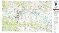
Tuscumbia, Alabama, USGS topographic map dated 1986.
Includes geographic coordinates (latitude and longitude). This topographic map is suitable for hiking, camping, and exploring, or framing it as a wall map.
Printed on-demand using high resolution imagery, on heavy weight and acid free paper, or alternatively on a variety of synthetic materials.
Topos available on paper, Waterproof, Poly, or Tyvek. Usually shipping rolled, unless combined with other folded maps in one order.
- Product Number: USGS-5542643
- Free digital map download (high-resolution, GeoPDF): Tuscumbia, Alabama (file size: 31 MB)
- Map Size: please refer to the dimensions of the GeoPDF map above
- Weight (paper map): ca. 55 grams
- Map Type: POD USGS Topographic Map
- Map Series: HTMC
- Map Verison: Historical
- Cell ID: 68497
- Scan ID: 305783
- Imprint Year: 1992
- Woodland Tint: Yes
- Visual Version Number: 1
- Aerial Photo Year: 1981
- Edit Year: 1986
- Datum: NAD27
- Map Projection: Universal Transverse Mercator
- Map published by United States Geological Survey
- Map published by Tennessee Valley Authority
- Map Language: English
- Scanner Resolution: 600 dpi
- Map Cell Name: Tuscumbia
- Grid size: 30 X 60 Minute
- Date on map: 1986
- Map Scale: 1:100000
- Geographical region: Alabama, United States
Neighboring Maps:
All neighboring USGS topo maps are available for sale online at a variety of scales.
Spatial coverage:
Topo map Tuscumbia, Alabama, covers the geographical area associated the following places:
- Bainbridge (historical) - Littleville - Heritage Estates - Pleasant Ridge - Hatton - Caddo Mobile Home Park - Hester Heights - Rose Park - New Bethel - Hub (historical) - Killen - Gatesville (historical) - Lock Three - Pinedale Acres - Atlas (historical) - Frankfort - Tuscumbia - Turner Chapel - Hillsboro - Mount Olive - Rogersville - Oka Kapassa (historical) - Concord - Pine Haven Shores - Hickory Hills - Cross Key - Midway - McGee (historical) - Anderson Creek Subdivision - Glenn Valley - Paradise Points - Cloverdale - Johnson Crossroads - Arkdell - Kendell (historical) - Sullivan Crossroads - Pruitton - Country Club Acres - James - Gipsy - Valdosta - Mecca (historical) - Cherry Grove - Manor Haven - North Port (historical) - Fairview - Milk Springs - Elgin - Shady Grove (historical) - Paradise Shores - Twin Brooks - Virginia Shores - Edmond - Washington Park - Lakeside Acres - Cartwright - Creekwood - Green Tree (historical) - Heathrow - Lingerlost - Center Star - Melrose - Ligon Springs - Lawson - Jerusalem - Wilson - Brides Hill - Bear Creek - Lester - Sherwood Forest - Cherokee - Lovelace Crossroads - Blue Springs Park - Austinville - Roberson Beach - Union Hill - Thorntontown - Shoemaker Springs (historical) - Glendale Estates - Newsome Springs - Loosier - Ezell Place - Courtland - Detroit Park - River Oaks - Woodlawn Heights - Ne Smith - Lauderdale Beach - Murphy Cross Roads - Village Number 1 - New Georgia (historical) - Nitrate City - Kingtown - McGee Town - Morningside Heights - Cedar Grove - Hideaway Hills - Greenbrier - Mountain Mills (historical) - Oak Grove
- Map Area ID: AREA3534.5-88-87
- Northwest corner Lat/Long code: USGSNW35-88
- Northeast corner Lat/Long code: USGSNE35-87
- Southwest corner Lat/Long code: USGSSW34.5-88
- Southeast corner Lat/Long code: USGSSE34.5-87
- Northern map edge Latitude: 35
- Southern map edge Latitude: 34.5
- Western map edge Longitude: -88
- Eastern map edge Longitude: -87


