
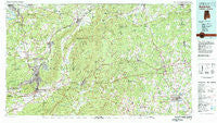
~ Anniston AL topo map, 1:100000 scale, 30 X 60 Minute, Historical, 1981, updated 1982
Anniston, Alabama, USGS topographic map dated 1981.
Includes geographic coordinates (latitude and longitude). This topographic map is suitable for hiking, camping, and exploring, or framing it as a wall map.
Printed on-demand using high resolution imagery, on heavy weight and acid free paper, or alternatively on a variety of synthetic materials.
Topos available on paper, Waterproof, Poly, or Tyvek. Usually shipping rolled, unless combined with other folded maps in one order.
- Product Number: USGS-5542571
- Free digital map download (high-resolution, GeoPDF): Anniston, Alabama (file size: 34 MB)
- Map Size: please refer to the dimensions of the GeoPDF map above
- Weight (paper map): ca. 55 grams
- Map Type: POD USGS Topographic Map
- Map Series: HTMC
- Map Verison: Historical
- Cell ID: 67055
- Scan ID: 305747
- Imprint Year: 1982
- Woodland Tint: Yes
- Aerial Photo Year: 1975
- Edit Year: 1981
- Datum: NAD27
- Map Projection: Universal Transverse Mercator
- Map published by United States Geological Survey
- Map Language: English
- Scanner Resolution: 600 dpi
- Map Cell Name: Anniston
- Grid size: 30 X 60 Minute
- Date on map: 1981
- Map Scale: 1:100000
- Geographical region: Alabama, United States
Neighboring Maps:
All neighboring USGS topo maps are available for sale online at a variety of scales.
Spatial coverage:
Topo map Anniston, Alabama, covers the geographical area associated the following places:
- Land-O-Plenty Subdivision - West Crossing - West Wellington - Knoxville - Parkwood - Clark (historical) - Holly Springs - Luckie (historical) - Wellington - Morrisville - Briarwood Estates - Bowdon - Rudd (historical) - Couch - Shady Grove - Laney - White Plains - Carrollton - Chulafinnee - Temple - Union - Bush - Peaceburg - Kentuck - Four Mile - Mink (historical) - Cleburne - New Haven - Friendship - Suburban Estates - Lakeview - Grant Town - Germania Springs (historical) - Bethel - Mack (historical) - Caseyville - Adelia (historical) - Jonesville - Old Davisville - Leydens Mill - Edwardsville - Hollingsworth - Glencoe - Sulphur Springs - Tecumseh Furnace - Arbacoochee (historical) - Blue Pond - Golden Springs - Colwell - Esom Hill - Angel - Fruithurst - June Bug (historical) - Union Hill - Greenway (historical) - Fairlawn Estates - Dugdown - Macedonia - Asberry - Mechanicsville - Cobb City - Kearney (historical) - Bera (historical) - Van Wert - Pelham Heights - Tallaseehatchee (historical) - Woodland Park - Spring Garden - Melrose - Halls Chapel - Coldwater - Fish - McFrey Crossroads - Forest Hills - Saks - Blue Springs - Boiling Spring - Double Branches - Weaver - Leatherwood - White - Piedmont - Latham (historical) - Benedict - West Point - Joseph Springs - Dailey (historical) - Chinnabee (historical) - Letchers - Cobb Town - Abernathy - Lowrimores Crossroads - Goshen (historical) - Pleasant Ridge - Borden Wheeler Springs - Blue Springs (historical) - Old Tallapoosa - Gold Hill - Plainview - Greenwood
- Map Area ID: AREA3433.5-86-85
- Northwest corner Lat/Long code: USGSNW34-86
- Northeast corner Lat/Long code: USGSNE34-85
- Southwest corner Lat/Long code: USGSSW33.5-86
- Southeast corner Lat/Long code: USGSSE33.5-85
- Northern map edge Latitude: 34
- Southern map edge Latitude: 33.5
- Western map edge Longitude: -86
- Eastern map edge Longitude: -85


