
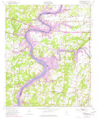
~ Riverside AL topo map, 1:24000 scale, 7.5 X 7.5 Minute, Historical, 1947, updated 1977
Riverside, Alabama, USGS topographic map dated 1947.
Includes geographic coordinates (latitude and longitude). This topographic map is suitable for hiking, camping, and exploring, or framing it as a wall map.
Printed on-demand using high resolution imagery, on heavy weight and acid free paper, or alternatively on a variety of synthetic materials.
Topos available on paper, Waterproof, Poly, or Tyvek. Usually shipping rolled, unless combined with other folded maps in one order.
- Product Number: USGS-5541183
- Free digital map download (high-resolution, GeoPDF): Riverside, Alabama (file size: 14 MB)
- Map Size: please refer to the dimensions of the GeoPDF map above
- Weight (paper map): ca. 55 grams
- Map Type: POD USGS Topographic Map
- Map Series: HTMC
- Map Verison: Historical
- Cell ID: 38055
- Scan ID: 304953
- Imprint Year: 1977
- Woodland Tint: Yes
- Photo Revision Year: 1972
- Aerial Photo Year: 1972
- Field Check Year: 1947
- Datum: NAD27
- Map Projection: Polyconic
- Map published by United States Geological Survey
- Map published by United States Army Corps of Engineers
- Map Language: English
- Scanner Resolution: 600 dpi
- Map Cell Name: Riverside
- Grid size: 7.5 X 7.5 Minute
- Date on map: 1947
- Map Scale: 1:24000
- Geographical region: Alabama, United States
Neighboring Maps:
All neighboring USGS topo maps are available for sale online at a variety of scales.
Spatial coverage:
Topo map Riverside, Alabama, covers the geographical area associated the following places:
- Wendy Wood - Mays Bend - Choccolocco Estates - Embry Crossroads - Ilamo - Davis Acres - England Isle - Binghamtown - Riverside - Seddon - Walker Subdivision - Stemley - Capri Islands - Stemley Cove - Enchanted Hills - Eureka - Eureka Shores - Blue Eye - Cape Choccolocco - Camelot Plateau - Clear Springs - Pleasant Grove - River Terrace Estates - Logan Martin Lake Estates - Windsong Island - Colony - Dunrowin
- Map Area ID: AREA33.62533.5-86.25-86.125
- Northwest corner Lat/Long code: USGSNW33.625-86.25
- Northeast corner Lat/Long code: USGSNE33.625-86.125
- Southwest corner Lat/Long code: USGSSW33.5-86.25
- Southeast corner Lat/Long code: USGSSE33.5-86.125
- Northern map edge Latitude: 33.625
- Southern map edge Latitude: 33.5
- Western map edge Longitude: -86.25
- Eastern map edge Longitude: -86.125


