
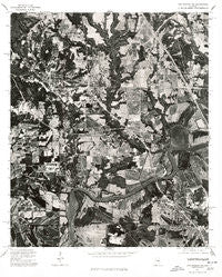
~ Montgomery NW AL topo map, 1:24000 scale, 7.5 X 7.5 Minute, Historical, 1975, updated 1977
Montgomery NW, Alabama, USGS topographic map dated 1975.
Includes geographic coordinates (latitude and longitude). This topographic map is suitable for hiking, camping, and exploring, or framing it as a wall map.
Printed on-demand using high resolution imagery, on heavy weight and acid free paper, or alternatively on a variety of synthetic materials.
Topos available on paper, Waterproof, Poly, or Tyvek. Usually shipping rolled, unless combined with other folded maps in one order.
- Product Number: USGS-5540479
- Free digital map download (high-resolution, GeoPDF): Montgomery NW, Alabama (file size: 22 MB)
- Map Size: please refer to the dimensions of the GeoPDF map above
- Weight (paper map): ca. 55 grams
- Map Type: POD USGS Topographic Map
- Map Series: HTMC
- Map Verison: Historical
- Cell ID: 36352
- Scan ID: 304593
- Imprint Year: 1977
- Aerial Photo Year: 1975
- Datum: NAD27
- Map Projection: Transverse Mercator
- Orthophoto: Quad
- Map published by United States Geological Survey
- Keywords: Nonstandard Press Run
- Map Language: English
- Scanner Resolution: 600 dpi
- Map Cell Name: Prattville
- Grid size: 7.5 X 7.5 Minute
- Date on map: 1975
- Map Scale: 1:24000
- Geographical region: Alabama, United States
Neighboring Maps:
All neighboring USGS topo maps are available for sale online at a variety of scales.
Spatial coverage:
Topo map Montgomery NW, Alabama, covers the geographical area associated the following places:
- Country Club Estates - Whispering Pines - Dosterville - Upper Kingston - Washington (historical) - Overlook - Live Oaks - Willowbrook - Melmar - Hunting Ridge - Prattmont - Onoqua (historical) - Brothers Mobile Home Park - Scenic Hills - Washington Hill - W C Rices Trailer Park - Woodland Heights - Autauga (historical) - Prattville - Fays - King Arthur Manor - Smithboro (historical) - Langford Mobile Home Park - Hunter
- Map Area ID: AREA32.532.375-86.5-86.375
- Northwest corner Lat/Long code: USGSNW32.5-86.5
- Northeast corner Lat/Long code: USGSNE32.5-86.375
- Southwest corner Lat/Long code: USGSSW32.375-86.5
- Southeast corner Lat/Long code: USGSSE32.375-86.375
- Northern map edge Latitude: 32.5
- Southern map edge Latitude: 32.375
- Western map edge Longitude: -86.5
- Eastern map edge Longitude: -86.375


