
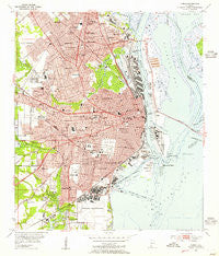
~ Mobile AL topo map, 1:24000 scale, 7.5 X 7.5 Minute, Historical, 1953, updated 1955
Mobile, Alabama, USGS topographic map dated 1953.
Includes geographic coordinates (latitude and longitude). This topographic map is suitable for hiking, camping, and exploring, or framing it as a wall map.
Printed on-demand using high resolution imagery, on heavy weight and acid free paper, or alternatively on a variety of synthetic materials.
Topos available on paper, Waterproof, Poly, or Tyvek. Usually shipping rolled, unless combined with other folded maps in one order.
- Product Number: USGS-5540443
- Free digital map download (high-resolution, GeoPDF): Mobile, Alabama (file size: 15 MB)
- Map Size: please refer to the dimensions of the GeoPDF map above
- Weight (paper map): ca. 55 grams
- Map Type: POD USGS Topographic Map
- Map Series: HTMC
- Map Verison: Historical
- Cell ID: 29698
- Scan ID: 304574
- Imprint Year: 1955
- Woodland Tint: Yes
- Survey Year: 1939
- Datum: NAD27
- Map Projection: Polyconic
- Map published by United States Geological Survey
- Map Language: English
- Scanner Resolution: 600 dpi
- Map Cell Name: Mobile
- Grid size: 7.5 X 7.5 Minute
- Date on map: 1953
- Map Scale: 1:24000
- Geographical region: Alabama, United States
Neighboring Maps:
All neighboring USGS topo maps are available for sale online at a variety of scales.
Spatial coverage:
Topo map Mobile, Alabama, covers the geographical area associated the following places:
- Neely - Shady Acres Mobile Home Court - Neshota - Forest Park - Magazine - Belvedere - Cox - Summerville - Farnell - Crichton - Griffith Mobile Home Park - Bridlewood - Mertz - Prichard - Navco - Allenville - Toulminville - Sibert - Brookwood - Tacon - Grand Oaks Mobile Home Court - Plateau - Mobile
- Map Area ID: AREA30.7530.625-88.125-88
- Northwest corner Lat/Long code: USGSNW30.75-88.125
- Northeast corner Lat/Long code: USGSNE30.75-88
- Southwest corner Lat/Long code: USGSSW30.625-88.125
- Southeast corner Lat/Long code: USGSSE30.625-88
- Northern map edge Latitude: 30.75
- Southern map edge Latitude: 30.625
- Western map edge Longitude: -88.125
- Eastern map edge Longitude: -88


