
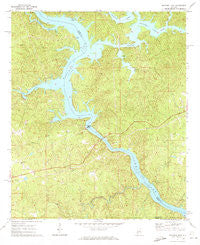
~ Mitchell Dam AL topo map, 1:24000 scale, 7.5 X 7.5 Minute, Historical, 1971, updated 1973
Mitchell Dam, Alabama, USGS topographic map dated 1971.
Includes geographic coordinates (latitude and longitude). This topographic map is suitable for hiking, camping, and exploring, or framing it as a wall map.
Printed on-demand using high resolution imagery, on heavy weight and acid free paper, or alternatively on a variety of synthetic materials.
Topos available on paper, Waterproof, Poly, or Tyvek. Usually shipping rolled, unless combined with other folded maps in one order.
- Product Number: USGS-5540437
- Free digital map download (high-resolution, GeoPDF): Mitchell Dam, Alabama (file size: 15 MB)
- Map Size: please refer to the dimensions of the GeoPDF map above
- Weight (paper map): ca. 55 grams
- Map Type: POD USGS Topographic Map
- Map Series: HTMC
- Map Verison: Historical
- Cell ID: 29660
- Scan ID: 304569
- Imprint Year: 1973
- Woodland Tint: Yes
- Aerial Photo Year: 1969
- Field Check Year: 1971
- Datum: NAD27
- Map Projection: Polyconic
- Map published by United States Geological Survey
- Map Language: English
- Scanner Resolution: 600 dpi
- Map Cell Name: Mitchell Dam
- Grid size: 7.5 X 7.5 Minute
- Date on map: 1971
- Map Scale: 1:24000
- Geographical region: Alabama, United States
Neighboring Maps:
All neighboring USGS topo maps are available for sale online at a variety of scales.
Spatial coverage:
Topo map Mitchell Dam, Alabama, covers the geographical area associated the following places:
- Flint Hill Church - Cargle Creek - Knights (historical) - Woodward Lake - Corinth Baptist Church - Shady Grove Methodist Church - Houses Island - Houses Ferry (historical) - Livingston Lake Dam - Noneless Creek - Pinchoulee Creek - Williams Cemetery - Knights Ferry (historical) - Blue Creek - Mitchell Lake - Chestnut Creek - Enid (historical) - Barretts Fish Camp - Poken Tallassee Council House (historical) - Clanton Pumping Station - Goat Island - Mount Sinai Cemetery - Burwell (historical) - Pollis Creek - Livingston Lake - Walnut Creek - Woodward Lake Dam - Big Island (historical) - Hatchet Creek - Bird Creek - Shady Grove Cemetery - Proctor Creek - Higgins Ferry (historical) - Mitchell Dam - Old Salem Cemetery - Corinth Cemetery - Patella Gin (historical) - Weogufka Creek - Pennymotley Creek - Mountain Creek - Sandy Creek
- Map Area ID: AREA32.87532.75-86.5-86.375
- Northwest corner Lat/Long code: USGSNW32.875-86.5
- Northeast corner Lat/Long code: USGSNE32.875-86.375
- Southwest corner Lat/Long code: USGSSW32.75-86.5
- Southeast corner Lat/Long code: USGSSE32.75-86.375
- Northern map edge Latitude: 32.875
- Southern map edge Latitude: 32.75
- Western map edge Longitude: -86.5
- Eastern map edge Longitude: -86.375


