
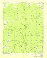
~ King Cove AL topo map, 1:24000 scale, 7.5 X 7.5 Minute, Historical, 1936
King Cove, Alabama, USGS topographic map dated 1936.
Includes geographic coordinates (latitude and longitude). This topographic map is suitable for hiking, camping, and exploring, or framing it as a wall map.
Printed on-demand using high resolution imagery, on heavy weight and acid free paper, or alternatively on a variety of synthetic materials.
Topos available on paper, Waterproof, Poly, or Tyvek. Usually shipping rolled, unless combined with other folded maps in one order.
- Product Number: USGS-5539965
- Free digital map download (high-resolution, GeoPDF): King Cove, Alabama (file size: 7 MB)
- Map Size: please refer to the dimensions of the GeoPDF map above
- Weight (paper map): ca. 55 grams
- Map Type: POD USGS Topographic Map
- Map Series: HTMC
- Map Verison: Historical
- Cell ID: 70566
- Scan ID: 304333
- Woodland Tint: Yes
- Field Check Year: 1936
- Datum: NAD27
- Map Projection: Polyconic
- Advance: Yes
- Map published by United States Geological Survey
- Map published by Tennessee Valley Authority
- Map Language: English
- Scanner Resolution: 600 dpi
- Map Cell Name: King Cove
- Grid size: 7.5 X 7.5 Minute
- Date on map: 1936
- Map Scale: 1:24000
- Geographical region: Alabama, United States
Neighboring Maps:
All neighboring USGS topo maps are available for sale online at a variety of scales.
Spatial coverage:
Topo map King Cove, Alabama, covers the geographical area associated the following places:
- Cagle Point - Honea (historical) - Hambrick Sinks - Beech Grove Cemetery - Dry Creek - Hambrick School - Putman Mountain - Low Gap - Shores Low Gap - Bice Mountain - Maxwell Cemetery - Crowell Cemetery - Hudson Cemetery - Moore Cove - Rochelle Hollow - Racepath Hollow - Husky Top - Beshears Point - Rocky Branch - Fanning Cemetery - Lick Branch - Johnson Top - Bluff Hollow - Lickskillet Creek - The Dugout - Moore Cove - High Top - Bee Branch - Maxwell Mountain - Bethel Cemetery - Cramer Hollow - Backbone Mountain - Hall Branch - Mountain Fork Church - King Cove Cemetery - Rocky Branch Hollow - Big Hill - Fitch Hollow - Hale Mountain - King Cove - Flag Branch - Beech Grove School (historical) - Hayes Cemetery - Smithey Hollow - Jones Cove
- Map Area ID: AREA3534.875-86.375-86.25
- Northwest corner Lat/Long code: USGSNW35-86.375
- Northeast corner Lat/Long code: USGSNE35-86.25
- Southwest corner Lat/Long code: USGSSW34.875-86.375
- Southeast corner Lat/Long code: USGSSE34.875-86.25
- Northern map edge Latitude: 35
- Southern map edge Latitude: 34.875
- Western map edge Longitude: -86.375
- Eastern map edge Longitude: -86.25


