
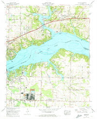
~ Killen AL topo map, 1:24000 scale, 7.5 X 7.5 Minute, Historical, 1971, updated 1973
Killen, Alabama, USGS topographic map dated 1971.
Includes geographic coordinates (latitude and longitude). This topographic map is suitable for hiking, camping, and exploring, or framing it as a wall map.
Printed on-demand using high resolution imagery, on heavy weight and acid free paper, or alternatively on a variety of synthetic materials.
Topos available on paper, Waterproof, Poly, or Tyvek. Usually shipping rolled, unless combined with other folded maps in one order.
- Product Number: USGS-5539957
- Free digital map download (high-resolution, GeoPDF): Killen, Alabama (file size: 13 MB)
- Map Size: please refer to the dimensions of the GeoPDF map above
- Weight (paper map): ca. 55 grams
- Map Type: POD USGS Topographic Map
- Map Series: HTMC
- Map Verison: Historical
- Cell ID: 23533
- Scan ID: 304330
- Imprint Year: 1973
- Woodland Tint: Yes
- Aerial Photo Year: 1967
- Field Check Year: 1971
- Datum: NAD27
- Map Projection: Polyconic
- Map published by United States Geological Survey
- Map published by Tennessee Valley Authority
- Map Language: English
- Scanner Resolution: 600 dpi
- Map Cell Name: Killen
- Grid size: 7.5 X 7.5 Minute
- Date on map: 1971
- Map Scale: 1:24000
- Geographical region: Alabama, United States
Neighboring Maps:
All neighboring USGS topo maps are available for sale online at a variety of scales.
Spatial coverage:
Topo map Killen, Alabama, covers the geographical area associated the following places:
- Evergreen Estates - Lockland - Bellemeade - Morningside Heights - Detroit Park - Davidsons Cross Roads (historical) - Lakeview Highlands - Listerhill - Lock Six - Indian Springs - Lake Coves - Bainbridge (historical) - Underwood Crossroads - Saint Florian - Wilson Lake Shores - Shoals Acres - Lauderdale Beach - Kingman (historical) - Elm Acres - Lakeview Heights - Ford City - Virginia Shores - East Killen - Lakeside Acres - Killen - Brooks Acres - Peytona Points - Alabama Shores - Village Pines - Paradise Points - Masonville (historical) - Mount Pleasant (historical) - Lakeview - Lakeview - Hideaway Hills - Emerald Shores - Wilson Heights - Nitrate City - Lingerlost - Lakeside Highlands - Sombrero Acres - Bainbridge (historical) - Sky Park - Steenson Hollow - Rivermont - Woodlawn
- Map Area ID: AREA34.87534.75-87.625-87.5
- Northwest corner Lat/Long code: USGSNW34.875-87.625
- Northeast corner Lat/Long code: USGSNE34.875-87.5
- Southwest corner Lat/Long code: USGSSW34.75-87.625
- Southeast corner Lat/Long code: USGSSE34.75-87.5
- Northern map edge Latitude: 34.875
- Southern map edge Latitude: 34.75
- Western map edge Longitude: -87.625
- Eastern map edge Longitude: -87.5


