
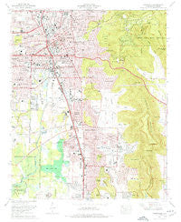
~ Huntsville AL topo map, 1:24000 scale, 7.5 X 7.5 Minute, Historical, 1975, updated 1976
Huntsville, Alabama, USGS topographic map dated 1975.
Includes geographic coordinates (latitude and longitude). This topographic map is suitable for hiking, camping, and exploring, or framing it as a wall map.
Printed on-demand using high resolution imagery, on heavy weight and acid free paper, or alternatively on a variety of synthetic materials.
Topos available on paper, Waterproof, Poly, or Tyvek. Usually shipping rolled, unless combined with other folded maps in one order.
- Product Number: USGS-5539747
- Free digital map download (high-resolution, GeoPDF): Huntsville, Alabama (file size: 14 MB)
- Map Size: please refer to the dimensions of the GeoPDF map above
- Weight (paper map): ca. 55 grams
- Map Type: POD USGS Topographic Map
- Map Series: HTMC
- Map Verison: Historical
- Cell ID: 21545
- Scan ID: 304226
- Imprint Year: 1976
- Woodland Tint: Yes
- Aerial Photo Year: 1974
- Field Check Year: 1975
- Datum: NAD27
- Map Projection: Polyconic
- Map published by United States Geological Survey
- Map published by Tennessee Valley Authority
- Map Language: English
- Scanner Resolution: 600 dpi
- Map Cell Name: Huntsville
- Grid size: 7.5 X 7.5 Minute
- Date on map: 1975
- Map Scale: 1:24000
- Geographical region: Alabama, United States
Neighboring Maps:
All neighboring USGS topo maps are available for sale online at a variety of scales.
Spatial coverage:
Topo map Huntsville, Alabama, covers the geographical area associated the following places:
- Fagen Springs Estates - Camelot - Bailey Cove Estates - Huntsville Hills - Parkway Estates - Five Points - Cavalry Hill - Echols Hill - Vestavia Estates - Double Tree - Bel Air Estates - Terry Heights - Willowbrook - Lily Flagg - Hillmont - Chelsea - Greenwycke Village - Willow Hills Estates - Mountain Heights - Mayfair - Westbury - Hillandale - Walker Woods - Byrd Springs - Flemington Heights - Whitesburg Estates - Rocky Top Estates - Willow Bend - Ridgewood - Forest Park - Belview Heights - Haden - Meadow Trace - Oak Park - Bravo - Oakwood - Darwin Downs - Fleming Meadows - South Gate - Tara - Huntsville Park - Russell Hill - Lincoln - Country Club Park - Bucks Canyon - Hillwood - Ryland Acres - Hillview Acres - Mountain Brook - Weatherly Heights - Sugar Tree - Sunset Cove - Willowbrook Estates - Oak Leaf - University Park - Fleming Hills - Jones Valley Estates - Piedmont - Dallas - Longwood - English Village - Union Park - West Huntsville - English Terrace - Huntsville - Canterbury - Pea Ridge - Tannahill Estates - Haysland Estates - Bluewood Estates
- Map Area ID: AREA34.7534.625-86.625-86.5
- Northwest corner Lat/Long code: USGSNW34.75-86.625
- Northeast corner Lat/Long code: USGSNE34.75-86.5
- Southwest corner Lat/Long code: USGSSW34.625-86.625
- Southeast corner Lat/Long code: USGSSE34.625-86.5
- Northern map edge Latitude: 34.75
- Southern map edge Latitude: 34.625
- Western map edge Longitude: -86.625
- Eastern map edge Longitude: -86.5


