
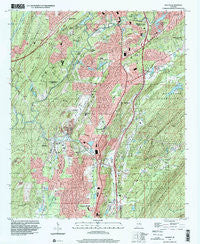
~ Helena AL topo map, 1:24000 scale, 7.5 X 7.5 Minute, Historical, 1997, updated 2001
Helena, Alabama, USGS topographic map dated 1997.
Includes geographic coordinates (latitude and longitude). This topographic map is suitable for hiking, camping, and exploring, or framing it as a wall map.
Printed on-demand using high resolution imagery, on heavy weight and acid free paper, or alternatively on a variety of synthetic materials.
Topos available on paper, Waterproof, Poly, or Tyvek. Usually shipping rolled, unless combined with other folded maps in one order.
- Product Number: USGS-5539575
- Free digital map download (high-resolution, GeoPDF): Helena, Alabama (file size: 17 MB)
- Map Size: please refer to the dimensions of the GeoPDF map above
- Weight (paper map): ca. 55 grams
- Map Type: POD USGS Topographic Map
- Map Series: HTMC
- Map Verison: Historical
- Cell ID: 70354
- Scan ID: 304139
- Imprint Year: 2001
- Woodland Tint: Yes
- Aerial Photo Year: 1997
- Datum: NAD83
- Map Projection: Universal Transverse Mercator
- Map published by United States Geological Survey
- Map Language: English
- Scanner Resolution: 600 dpi
- Map Cell Name: Helena
- Grid size: 7.5 X 7.5 Minute
- Date on map: 1997
- Map Scale: 1:24000
- Geographical region: Alabama, United States
Neighboring Maps:
All neighboring USGS topo maps are available for sale online at a variety of scales.
Spatial coverage:
Topo map Helena, Alabama, covers the geographical area associated the following places:
- Valdawood - Indian Hills - Wooddale - Keystone - Indian Springs Ranch - Indian Springs Village - Shannon Glen - Scottrock - Valley Station - Navajo Hills - Shades Acres - Blueberry Estates - Rolling Ridge - Roebuck - Calliston - Acton - Dunaway Farms - Deer Springs Estates - Cahaba Valley Estates - Mars Hill - Timbercrest - Helena - Elvira - Hunters Glen (historical) - Cahaba River Estates - Hardy - Chandalar South - Fox Haven - Dearing Downs - Kingwood - Indian Lake Estates - Shady Acres Estates - Valley Forge - Falliston - Navajo Pines - Southlake - Port South - Mallard Point - Tacoa - Little Oak Ridge Estates - Quail Run - Fungo Hollow - Paramount - Pelham - Royal Oaks - Deerhurst
- Map Area ID: AREA33.37533.25-86.875-86.75
- Northwest corner Lat/Long code: USGSNW33.375-86.875
- Northeast corner Lat/Long code: USGSNE33.375-86.75
- Southwest corner Lat/Long code: USGSSW33.25-86.875
- Southeast corner Lat/Long code: USGSSE33.25-86.75
- Northern map edge Latitude: 33.375
- Southern map edge Latitude: 33.25
- Western map edge Longitude: -86.875
- Eastern map edge Longitude: -86.75


