
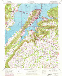
~ Guntersville AL topo map, 1:24000 scale, 7.5 X 7.5 Minute, Historical, 1948, updated 1972
Guntersville, Alabama, USGS topographic map dated 1948.
Includes geographic coordinates (latitude and longitude). This topographic map is suitable for hiking, camping, and exploring, or framing it as a wall map.
Printed on-demand using high resolution imagery, on heavy weight and acid free paper, or alternatively on a variety of synthetic materials.
Topos available on paper, Waterproof, Poly, or Tyvek. Usually shipping rolled, unless combined with other folded maps in one order.
- Product Number: USGS-5539435
- Free digital map download (high-resolution, GeoPDF): Guntersville, Alabama (file size: 16 MB)
- Map Size: please refer to the dimensions of the GeoPDF map above
- Weight (paper map): ca. 55 grams
- Map Type: POD USGS Topographic Map
- Map Series: HTMC
- Map Verison: Historical
- Cell ID: 18770
- Scan ID: 304065
- Imprint Year: 1972
- Woodland Tint: Yes
- Visual Version Number: 1
- Photo Revision Year: 1970
- Aerial Photo Year: 1970
- Field Check Year: 1948
- Datum: NAD27
- Map Projection: Transverse Mercator
- Map published by United States Geological Survey
- Map published by Tennessee Valley Authority
- Map Language: English
- Scanner Resolution: 600 dpi
- Map Cell Name: Guntersville
- Grid size: 7.5 X 7.5 Minute
- Date on map: 1948
- Map Scale: 1:24000
- Geographical region: Alabama, United States
Neighboring Maps:
All neighboring USGS topo maps are available for sale online at a variety of scales.
Spatial coverage:
Topo map Guntersville, Alabama, covers the geographical area associated the following places:
- Gregory (historical) - Sandy Point Subdivision - Warrenton Subdivision - Rabbit Town - Mill Village - Wyeth City - Crossroads - Smith Shores - Street (historical) - Lakeview - Rayburn - Signal Point Subdivision - Big Spring Creek Subdivision - Guntersville - Mountain View - Lindsay Lane - Morrow Acres - Meadow Wood - Country Club Estates - Sidney - Hide Away Acres - Lattiwood - Southtown - Sunrise Shores - Warrenton - Pleasant Grove - Guntersville Shores
- Map Area ID: AREA34.37534.25-86.375-86.25
- Northwest corner Lat/Long code: USGSNW34.375-86.375
- Northeast corner Lat/Long code: USGSNE34.375-86.25
- Southwest corner Lat/Long code: USGSSW34.25-86.375
- Southeast corner Lat/Long code: USGSSE34.25-86.25
- Northern map edge Latitude: 34.375
- Southern map edge Latitude: 34.25
- Western map edge Longitude: -86.375
- Eastern map edge Longitude: -86.25


