
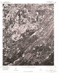
~ Greenwood AL topo map, 1:24000 scale, 7.5 X 7.5 Minute, Historical, 1975, updated 1977
Greenwood, Alabama, USGS topographic map dated 1975.
Includes geographic coordinates (latitude and longitude). This topographic map is suitable for hiking, camping, and exploring, or framing it as a wall map.
Printed on-demand using high resolution imagery, on heavy weight and acid free paper, or alternatively on a variety of synthetic materials.
Topos available on paper, Waterproof, Poly, or Tyvek. Usually shipping rolled, unless combined with other folded maps in one order.
- Product Number: USGS-5539397
- Free digital map download (high-resolution, GeoPDF): Greenwood, Alabama (file size: 24 MB)
- Map Size: please refer to the dimensions of the GeoPDF map above
- Weight (paper map): ca. 55 grams
- Map Type: POD USGS Topographic Map
- Map Series: HTMC
- Map Verison: Historical
- Cell ID: 18486
- Scan ID: 304048
- Imprint Year: 1977
- Aerial Photo Year: 1975
- Datum: NAD27
- Map Projection: Transverse Mercator
- Orthophoto: Quad
- Map published by United States Geological Survey
- Keywords: Nonstandard Press Run
- Map Language: English
- Scanner Resolution: 600 dpi
- Map Cell Name: Greenwood
- Grid size: 7.5 X 7.5 Minute
- Date on map: 1975
- Map Scale: 1:24000
- Geographical region: Alabama, United States
Neighboring Maps:
All neighboring USGS topo maps are available for sale online at a variety of scales.
Spatial coverage:
Topo map Greenwood, Alabama, covers the geographical area associated the following places:
- Smithson - High Point - Shades Run - Pleasant Hill - Eden Ridge - Phillips Estates - Shadywood - Parkwood - Raimund - Rice - Genery - Shady Brook - Hopewell - Pine Crest - Laceys Chapel - Bluff Ridge Subdivision - Bamford - Hilltop - Mossboro - Whispering Oaks - Parkwood Hills - Southpointe - Greenwood - Fox Trace - Scott Crest Subdivision - Cherokee Beach - Rockdale - Eastern Valley - Coalmont - Morgan - Highlands - Mobile Junction - Weeping Oaks - Loveless Park - Summit Farm - Chestnut Glen - Hickory Grove - Russet Woods
- Map Area ID: AREA33.37533.25-87-86.875
- Northwest corner Lat/Long code: USGSNW33.375-87
- Northeast corner Lat/Long code: USGSNE33.375-86.875
- Southwest corner Lat/Long code: USGSSW33.25-87
- Southeast corner Lat/Long code: USGSSE33.25-86.875
- Northern map edge Latitude: 33.375
- Southern map edge Latitude: 33.25
- Western map edge Longitude: -87
- Eastern map edge Longitude: -86.875


