
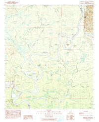
~ Ginhouse Island AL topo map, 1:24000 scale, 7.5 X 7.5 Minute, Historical, 1984, updated 1984
Ginhouse Island, Alabama, USGS topographic map dated 1984.
Includes geographic coordinates (latitude and longitude). This topographic map is suitable for hiking, camping, and exploring, or framing it as a wall map.
Printed on-demand using high resolution imagery, on heavy weight and acid free paper, or alternatively on a variety of synthetic materials.
Topos available on paper, Waterproof, Poly, or Tyvek. Usually shipping rolled, unless combined with other folded maps in one order.
- Product Number: USGS-5539257
- Free digital map download (high-resolution, GeoPDF): Ginhouse Island, Alabama (file size: 10 MB)
- Map Size: please refer to the dimensions of the GeoPDF map above
- Weight (paper map): ca. 55 grams
- Map Type: POD USGS Topographic Map
- Map Series: HTMC
- Map Verison: Historical
- Cell ID: 17297
- Scan ID: 303977
- Imprint Year: 1984
- Woodland Tint: Yes
- Aerial Photo Year: 1976
- Edit Year: 1984
- Field Check Year: 1977
- Datum: NAD27
- Map Projection: Transverse Mercator
- Map published by United States Geological Survey
- Map Language: English
- Scanner Resolution: 600 dpi
- Map Cell Name: Ginhouse Island
- Grid size: 7.5 X 7.5 Minute
- Date on map: 1984
- Map Scale: 1:24000
- Geographical region: Alabama, United States
Neighboring Maps:
All neighboring USGS topo maps are available for sale online at a variety of scales.
Spatial coverage:
Topo map Ginhouse Island, Alabama, covers the geographical area associated the following places:
- Lower Duck Pond - Fishing Lake - Side Lake Bayou - Oven Bluff Fishing Camp - Cypress Knee Gut - Whistlers Landing (historical) - Three Rivers Lake - Ciba Geigy McIntosh Plant Pond 1 - Monger Island - Hunters Slough - Batchelors Landing - Newman Bend - Gate Pond - McIntosh Bluff - Ginhouse Island - Big Duck Roost - Sunflower Junior High School (historical) - Dunlap Lake - D R Dunlap Estate Dam - Lyman Bayou - Crane Pond - Green Lake - Lewis Creek - Flag Lake - Johnsons Landing (historical) - Monger Creek - Jones Gut - Johnson Slough - Three Rivers - Fishing Lake - Graves Creek - Salt Gut - Oven Landing - Boggy Gut - Berris Landing - Otter Bayou - South Lake - Hals Lake - Johnsons Creek - Mud Swamp - Days Bar - Bull Ridge Pond - Burnt Cypress Gut - Middle Gut - Ginhouse Lake - Bear Lake - Monger Lake - Hillman Pond - Gander Lake - Dunham Pond - Ciba Geigy McIntosh Plant Pond 2 - The Cove - Holders Ferry (historical) - Horseshoe Bend - Round Island - Export Landing - Alexander Landing (historical) - Little Duck Roost - Oven Bluff - Vaughns Landing (historical) - Moore Lake - McIntosh Landing - Duck Pond - Johnson Lake
- Map Area ID: AREA31.37531.25-88-87.875
- Northwest corner Lat/Long code: USGSNW31.375-88
- Northeast corner Lat/Long code: USGSNE31.375-87.875
- Southwest corner Lat/Long code: USGSSW31.25-88
- Southeast corner Lat/Long code: USGSSE31.25-87.875
- Northern map edge Latitude: 31.375
- Southern map edge Latitude: 31.25
- Western map edge Longitude: -88
- Eastern map edge Longitude: -87.875


