
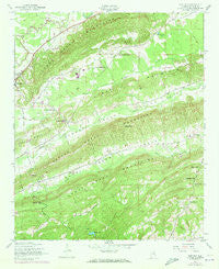
~ Cox Gap AL topo map, 1:24000 scale, 7.5 X 7.5 Minute, Historical, 1947, updated 1948
Cox Gap, Alabama, USGS topographic map dated 1947.
Includes geographic coordinates (latitude and longitude). This topographic map is suitable for hiking, camping, and exploring, or framing it as a wall map.
Printed on-demand using high resolution imagery, on heavy weight and acid free paper, or alternatively on a variety of synthetic materials.
Topos available on paper, Waterproof, Poly, or Tyvek. Usually shipping rolled, unless combined with other folded maps in one order.
- Product Number: USGS-5538519
- Free digital map download (high-resolution, GeoPDF): Cox Gap, Alabama (file size: 12 MB)
- Map Size: please refer to the dimensions of the GeoPDF map above
- Weight (paper map): ca. 55 grams
- Map Type: POD USGS Topographic Map
- Map Series: HTMC
- Map Verison: Historical
- Cell ID: 10479
- Scan ID: 303597
- Imprint Year: 1948
- Woodland Tint: Yes
- Visual Version Number: 1
- Photo Revision Year: 1974
- Aerial Photo Year: 1972
- Field Check Year: 1947
- Datum: NAD27
- Map Projection: Polyconic
- Map published by United States Geological Survey
- Map published by United States Army Corps of Engineers
- Map Language: English
- Scanner Resolution: 600 dpi
- Map Cell Name: Cox Gap
- Grid size: 7.5 X 7.5 Minute
- Date on map: 1947
- Map Scale: 1:24000
- Geographical region: Alabama, United States
Neighboring Maps:
All neighboring USGS topo maps are available for sale online at a variety of scales.
Spatial coverage:
Topo map Cox Gap, Alabama, covers the geographical area associated the following places:
- Horseshoe Gap - Poplar Springs Church - Cox Gap - Zion Hill Church (historical) - Gibson Gap - Allula (historical) - Nichols Gap - Borders Dam - Jones Mill (historical) - Hopewell Church - Bethany Cemetery - Rarris Mill (historical) - Cox Mill (historical) - Dobbins Quarry - Macedonia Cemetery - Musgrove Church (historical) - Laytons Store (historical) - Pilgrims Rest Church (historical) - Borders Lake - Gulf Creek - Macedonia Church - Jones School (historical) - Mount Castle School (historical) - Greensport Baptist Church - Whiteoak Creek - Looney Gap - Shoal Creek Mountains - Grace Church - Free Will Church - Morgan Lake - Baswell Lake - Bryant School (historical) - Weeping Mary Church - Backbone Ridge - Leighton Gap - Bethany Baptist Church - Gum Springs Church - Yarbroughs Mill (historical) - Canoe Creek Mountains - Baswell Dam - Ragland Division - Dugger's Field - Poplar Spring School (historical)
- Map Area ID: AREA33.87533.75-86.25-86.125
- Northwest corner Lat/Long code: USGSNW33.875-86.25
- Northeast corner Lat/Long code: USGSNE33.875-86.125
- Southwest corner Lat/Long code: USGSSW33.75-86.25
- Southeast corner Lat/Long code: USGSSE33.75-86.125
- Northern map edge Latitude: 33.875
- Southern map edge Latitude: 33.75
- Western map edge Longitude: -86.25
- Eastern map edge Longitude: -86.125


