
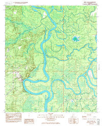
~ Bilbo Island AL topo map, 1:24000 scale, 7.5 X 7.5 Minute, Historical, 1983, updated 1983
Bilbo Island, Alabama, USGS topographic map dated 1983.
Includes geographic coordinates (latitude and longitude). This topographic map is suitable for hiking, camping, and exploring, or framing it as a wall map.
Printed on-demand using high resolution imagery, on heavy weight and acid free paper, or alternatively on a variety of synthetic materials.
Topos available on paper, Waterproof, Poly, or Tyvek. Usually shipping rolled, unless combined with other folded maps in one order.
- Product Number: USGS-5537809
- Free digital map download (high-resolution, GeoPDF): Bilbo Island, Alabama (file size: 12 MB)
- Map Size: please refer to the dimensions of the GeoPDF map above
- Weight (paper map): ca. 55 grams
- Map Type: POD USGS Topographic Map
- Map Series: HTMC
- Map Verison: Historical
- Cell ID: 3915
- Scan ID: 654274
- Imprint Year: 1983
- Woodland Tint: Yes
- Aerial Photo Year: 1976
- Edit Year: 1983
- Field Check Year: 1977
- Datum: NAD27
- Map Projection: Transverse Mercator
- Provisional map: Yes
- Map published by United States Geological Survey
- Map Language: English
- Scanner Resolution: 508 dpi
- Map Cell Name: Bilbo Island
- Grid size: 7.5 X 7.5 Minute
- Date on map: 1983
- Map Scale: 1:24000
- Geographical region: Alabama, United States
Neighboring Maps:
All neighboring USGS topo maps are available for sale online at a variety of scales.
Spatial coverage:
Topo map Bilbo Island, Alabama, covers the geographical area associated the following places:
- Bates Landing Fish Camp - Gilbert Lake - Doctor Lake - Singleton Lake - Laurel Shanty Landing - African Methodist Church - Griers Creek - Blue Ford Landing - Friendship Missionary Baptist Church - Poll Bayou - Calvert Landing - Woodyard Gut - Millers Landing (historical) - Bilbo Creek - Pierce Landing - Bilbos Landing (historical) - Franklin (historical) - Nanahubba Bluff - Joe Bayou - Seaboard Landing - Hellcat Lake - Alabama River - East Maher Landing - Boykin Junior High School - Deep Slough - West Maher Landing - Wilken Bend - Big John Cemetery - Seaboard Bluff - Bates Lake - Alabama River Cutoff - Jim Burns Island - Horsepen Creek - Friendship Church - Alligator Slide - Bear Creek - Bates Creek - West River - Big John Baptist Church - Bilbo Island - Bearpen Gut - Greers Landing - Tombigbee River - East Calvert School - Millers - Pine Bluff Landing - Calverts Bar - Franklins Landing (historical) - Turpin Slough - East Malcom School - Greater Mount Calvary Baptist Church - Jim Burr Lake - Webbs Landing - Why Not Hunting Club - Little Poll Bayou - Simes Landing (historical) - Wilken Bend Landing (historical) - Hooks Lake
- Map Area ID: AREA31.2531.125-88-87.875
- Northwest corner Lat/Long code: USGSNW31.25-88
- Northeast corner Lat/Long code: USGSNE31.25-87.875
- Southwest corner Lat/Long code: USGSSW31.125-88
- Southeast corner Lat/Long code: USGSSE31.125-87.875
- Northern map edge Latitude: 31.25
- Southern map edge Latitude: 31.125
- Western map edge Longitude: -88
- Eastern map edge Longitude: -87.875


