
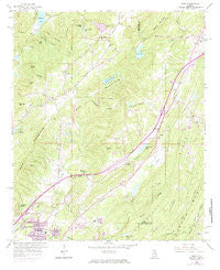
~ Argo AL topo map, 1:24000 scale, 7.5 X 7.5 Minute, Historical, 1959, updated 1985
Argo, Alabama, USGS topographic map dated 1959.
Includes geographic coordinates (latitude and longitude). This topographic map is suitable for hiking, camping, and exploring, or framing it as a wall map.
Printed on-demand using high resolution imagery, on heavy weight and acid free paper, or alternatively on a variety of synthetic materials.
Topos available on paper, Waterproof, Poly, or Tyvek. Usually shipping rolled, unless combined with other folded maps in one order.
- Product Number: USGS-5537615
- Free digital map download (high-resolution, GeoPDF): Argo, Alabama (file size: 14 MB)
- Map Size: please refer to the dimensions of the GeoPDF map above
- Weight (paper map): ca. 55 grams
- Map Type: POD USGS Topographic Map
- Map Series: HTMC
- Map Verison: Historical
- Cell ID: 1393
- Scan ID: 303131
- Imprint Year: 1985
- Woodland Tint: Yes
- Photo Revision Year: 1970
- Aerial Photo Year: 1970
- Field Check Year: 1959
- Datum: NAD27
- Map Projection: Polyconic
- Map published by United States Geological Survey
- Map Language: English
- Scanner Resolution: 600 dpi
- Map Cell Name: Argo
- Grid size: 7.5 X 7.5 Minute
- Date on map: 1959
- Map Scale: 1:24000
- Geographical region: Alabama, United States
Neighboring Maps:
All neighboring USGS topo maps are available for sale online at a variety of scales.
Spatial coverage:
Topo map Argo, Alabama, covers the geographical area associated the following places:
- Confederate Estates - Parsons - Breakstone Village - Argo - Misty Pines - East Trussville (historical) - Sunnyside - Dogwood Estates - Roddams Trailer Park - Ayres - Cahaba Crest - Rolling Hills - Cotton Ridge - Near Acres Estates - West Ridge - Clay - Meadowview Estates - Southern Acres - Ayres Estates - Cahaba Village - Moss Rock - Sherman Oaks - Eagle Ridge - Woodward - Vanns - Countryside Estates - Candlewood Lakes - Echo Hills - Saddlewood
- Map Area ID: AREA33.7533.625-86.625-86.5
- Northwest corner Lat/Long code: USGSNW33.75-86.625
- Northeast corner Lat/Long code: USGSNE33.75-86.5
- Southwest corner Lat/Long code: USGSSW33.625-86.625
- Southeast corner Lat/Long code: USGSSE33.625-86.5
- Northern map edge Latitude: 33.75
- Southern map edge Latitude: 33.625
- Western map edge Longitude: -86.625
- Eastern map edge Longitude: -86.5


