
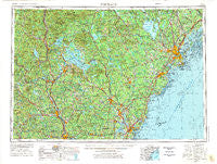
~ Portland ME topo map, 1:250000 scale, 1 X 2 Degree, Historical, 1956, updated 1975
Portland, Maine, USGS topographic map dated 1956.
Includes geographic coordinates (latitude and longitude). This topographic map is suitable for hiking, camping, and exploring, or framing it as a wall map.
Printed on-demand using high resolution imagery, on heavy weight and acid free paper, or alternatively on a variety of synthetic materials.
Topos available on paper, Waterproof, Poly, or Tyvek. Usually shipping rolled, unless combined with other folded maps in one order.
- Product Number: USGS-5537465
- Free digital map download (high-resolution, GeoPDF): Portland, Maine (file size: 21 MB)
- Map Size: please refer to the dimensions of the GeoPDF map above
- Weight (paper map): ca. 55 grams
- Map Type: POD USGS Topographic Map
- Map Series: HTMC
- Map Verison: Historical
- Cell ID: 68970
- Scan ID: 707527
- Imprint Year: 1975
- Woodland Tint: Yes
- Visual Version Number: 1
- Aerial Photo Year: 1972
- Edit Year: 1972
- Field Check Year: 1956
- Datum: Unstated
- Map Projection: Transverse Mercator
- Map published by United States Geological Survey
- Map Language: English
- Scanner Resolution: 508 dpi
- Map Cell Name: Portland
- Grid size: 1 X 2 Degree
- Date on map: 1956
- Map Scale: 1:250000
- Geographical region: Maine, United States
Neighboring Maps:
All neighboring USGS topo maps are available for sale online at a variety of scales.
Spatial coverage:
Topo map Portland, Maine, covers the geographical area associated the following places:
- North Wakefield - Ossipee Mills - South Lebanon - Plymouth - Parker - Glantz Corner - Hollis Center - Meredith Center - Riverton - Lords Hill (historical) - Pike Corner - Gilford - Clinton Village - Greenland Station - South Barrington - Suncook - Saywards Corner - Grand Beach - Northwood - Hills Corner - East Sutton - Durgintown - Weirs Beach - Henniker - Pownal Center - Pittsfield - Bar Mills - Wonalancet - Newfield - Town House Corners - York Landing - Bunganuc Landing - Perrys Corner - Loudon Center - Wolfeboro - Henniker Junction - Bartlett Mills - Union - Pejepscot - Dorchester - Campton Station - Crams Corner - Rosemont - York Heights - Camp Hedding - Falmouth Foreside - Wilmot Flat - West Hollis - Lower Landing - South Gorham - East Bear Island - North Parsonsfield - Dow Corner - Groveville - Stockbridge Corner - North Pembroke - Webster - West Thornton - Kimballs Corner - Crescent Lake - Central Park - Shaw Mills - Meaderboro Corner - Fort Lyon - North Sandwich - West Pownal - Tory Hill - Porter Landing - Strafford - Wells - Hopkinton - Dry Mills - Granite - Summit View Park (historical) - West Hopkinton - Emory Corner - Cumberland Center Station - South Harpswell - Maplewood - Madbury - Emery Mills - Cheever - Rigby (historical) - Springvale - Cape Cottage - Sargent (historical) - Long Beach - Martin - Rosemary - East Deering - Scribners Corner - South Naples - West End - Center Sandwich - Hill - Bay View - New Durham Corner - Town House - Tobeys Corner - Lyford Crossing
- Map Area ID: AREA4443-72-70
- Northwest corner Lat/Long code: USGSNW44-72
- Northeast corner Lat/Long code: USGSNE44-70
- Southwest corner Lat/Long code: USGSSW43-72
- Southeast corner Lat/Long code: USGSSE43-70
- Northern map edge Latitude: 44
- Southern map edge Latitude: 43
- Western map edge Longitude: -72
- Eastern map edge Longitude: -70


