
~ Lewiston ME topo map, 1:100000 scale, 30 X 60 Minute, Historical, 1986, updated 1986
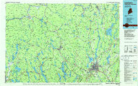
Lewiston, Maine, USGS topographic map dated 1986.
Includes geographic coordinates (latitude and longitude). This topographic map is suitable for hiking, camping, and exploring, or framing it as a wall map.
Printed on-demand using high resolution imagery, on heavy weight and acid free paper, or alternatively on a variety of synthetic materials.
Topos available on paper, Waterproof, Poly, or Tyvek. Usually shipping rolled, unless combined with other folded maps in one order.
- Product Number: USGS-5537373
- Free digital map download (high-resolution, GeoPDF): Lewiston, Maine (file size: 19 MB)
- Map Size: please refer to the dimensions of the GeoPDF map above
- Weight (paper map): ca. 55 grams
- Map Type: POD USGS Topographic Map
- Map Series: HTMC
- Map Verison: Historical
- Cell ID: 67840
- Scan ID: 808020
- Imprint Year: 1986
- Woodland Tint: Yes
- Aerial Photo Year: 1981
- Edit Year: 1986
- Datum: NAD27
- Map Projection: Universal Transverse Mercator
- Planimetric: Yes
- Map published by United States Geological Survey
- Map Language: English
- Scanner Resolution: 508 dpi
- Map Cell Name: Lewiston
- Grid size: 30 X 60 Minute
- Date on map: 1986
- Map Scale: 1:100000
- Geographical region: Maine, United States
Neighboring Maps:
All neighboring USGS topo maps are available for sale online at a variety of scales.
Spatial coverage:
Topo map Lewiston, Maine, covers the geographical area associated the following places:
- Livermore Center - Stevens Mill - North Wayne - Turner Center - Richmond Mill - Murphy Corner - Blake Corner - South Woodstock - Greene - South Waterford - West Bridgton - West Bowdoin - South Turner - East Livermore - Sandy Creek - South Leeds - Sprague Mill - Norway Lake - Auburn - East Peru - South Lewiston - Center Minot - Leeds - Gilbertville - Stuarts Corner - East Auburn - Oxford Station - Oxford - Brimstone Corner - Higgins Corner - Foggs Corner - West Auburn - Chase Mills - Otisfield Gore - Fayette Corner - Stricklands - Casco - Drinkwater Corner - Plummer Landing - Hartford - Harmons Corner - Waterford Flat - Fryeburg Center - Paris - Fish Street - Empire - Livermore Falls - Greenwood - Curtis Corner - Danville - Lisbon Center - Lisbon - North Bridgton - East Otisfield - Abbotts Mill - Minot - Rayville - North Fryeburg - North Woodstock - Rumford Junction - Howes Corner - Highland Park - Milton - Kents Hill - Monmouth - West Mount Vernon - Fayette - East Stoneham - North Monmouth - Bethel - Hanover - East Wales - North Lovell - Youngs Corner - Oak Hill - Hastings - Middle Intervale - Twelve Corners - Merrow Landing - Wales Corner - East Fryeburg - Canton Point - Meadowview - Littlefield Corner - East Buckfield - Nobles Corner - South Paris - Chisholm - West Bethel - Greene Corner - Webster Corner - Redding - Welchville - West Paris - East Poland - West Sumner - Bolsters Mills - North Auburn - East Bethel - North Turner
- Map Area ID: AREA44.544-71-70
- Northwest corner Lat/Long code: USGSNW44.5-71
- Northeast corner Lat/Long code: USGSNE44.5-70
- Southwest corner Lat/Long code: USGSSW44-71
- Southeast corner Lat/Long code: USGSSE44-70
- Northern map edge Latitude: 44.5
- Southern map edge Latitude: 44
- Western map edge Longitude: -71
- Eastern map edge Longitude: -70


