
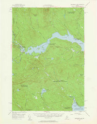
~ Seboomook Lake ME topo map, 1:62500 scale, 15 X 15 Minute, Historical, 1954, updated 1960
Seboomook Lake, Maine, USGS topographic map dated 1954.
Includes geographic coordinates (latitude and longitude). This topographic map is suitable for hiking, camping, and exploring, or framing it as a wall map.
Printed on-demand using high resolution imagery, on heavy weight and acid free paper, or alternatively on a variety of synthetic materials.
Topos available on paper, Waterproof, Poly, or Tyvek. Usually shipping rolled, unless combined with other folded maps in one order.
- Product Number: USGS-5537051
- Free digital map download (high-resolution, GeoPDF): Seboomook Lake, Maine (file size: 6 MB)
- Map Size: please refer to the dimensions of the GeoPDF map above
- Weight (paper map): ca. 55 grams
- Map Type: POD USGS Topographic Map
- Map Series: HTMC
- Map Verison: Historical
- Cell ID: 62245
- Scan ID: 306770
- Imprint Year: 1960
- Woodland Tint: Yes
- Aerial Photo Year: 1954
- Field Check Year: 1954
- Datum: NAD27
- Map Projection: Polyconic
- Map published by United States Geological Survey
- Map Language: English
- Scanner Resolution: 600 dpi
- Map Cell Name: Seboomook Lake
- Grid size: 15 X 15 Minute
- Date on map: 1954
- Map Scale: 1:62500
- Geographical region: Maine, United States
Neighboring Maps:
All neighboring USGS topo maps are available for sale online at a variety of scales.
Spatial coverage:
Topo map Seboomook Lake, Maine, covers the geographical area associated the following places:
- Seboomook Forestry District Headquarters Heliport - Foley Outlet - Seboomook Mountain - Beaver Brook - West Branch Gulliver Brook - Sevenmile Hill - Warden Camp - Long Brook - South Branch Carry Brook - Township of Plymouth - Little Lane Brook - Center Pond - Socatean Bay - Public Lot Brook - Socatean Stream - Socatean Bay Airport - West Middlesex Canal Grant Township - Logan Brook - Pittston Farm - Seboomook Lake - Gulliver Brook - T4 R17 WELS - Dipper Pond - North Branch Penobscot River - Mansell Brook - Township of Soldiertown - North Branch Carry Brook - Tomhegan Pond - Nulhedus Stream - South Branch Penobscot River - Socatean Pond - Lane Brook - Canada Falls Dam - East Branch Gulliver Brook - Socatean Point
- Map Area ID: AREA4645.75-70-69.75
- Northwest corner Lat/Long code: USGSNW46-70
- Northeast corner Lat/Long code: USGSNE46-69.75
- Southwest corner Lat/Long code: USGSSW45.75-70
- Southeast corner Lat/Long code: USGSSE45.75-69.75
- Northern map edge Latitude: 46
- Southern map edge Latitude: 45.75
- Western map edge Longitude: -70
- Eastern map edge Longitude: -69.75


