
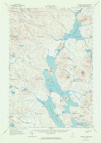
~ Churchill Lake ME topo map, 1:62500 scale, 15 X 15 Minute, Historical, 1962, updated 1964
Churchill Lake, Maine, USGS topographic map dated 1962.
Includes geographic coordinates (latitude and longitude). This topographic map is suitable for hiking, camping, and exploring, or framing it as a wall map.
Printed on-demand using high resolution imagery, on heavy weight and acid free paper, or alternatively on a variety of synthetic materials.
Topos available on paper, Waterproof, Poly, or Tyvek. Usually shipping rolled, unless combined with other folded maps in one order.
- Product Number: USGS-5536333
- Free digital map download (high-resolution, GeoPDF): Churchill Lake, Maine (file size: 5 MB)
- Map Size: please refer to the dimensions of the GeoPDF map above
- Weight (paper map): ca. 55 grams
- Map Type: POD USGS Topographic Map
- Map Series: HTMC
- Map Verison: Historical
- Cell ID: 52579
- Scan ID: 306525
- Imprint Year: 1964
- Aerial Photo Year: 1960
- Field Check Year: 1962
- Datum: NAD27
- Map Projection: Polyconic
- Map published by United States Geological Survey
- Map Language: English
- Scanner Resolution: 600 dpi
- Map Cell Name: Churchill Lake
- Grid size: 15 X 15 Minute
- Date on map: 1962
- Map Scale: 1:62500
- Geographical region: Maine, United States
Neighboring Maps:
All neighboring USGS topo maps are available for sale online at a variety of scales.
Spatial coverage:
Topo map Churchill Lake, Maine, covers the geographical area associated the following places:
- Poulin Brook - Bear Mountain - Johns Bridge - Lower Russell Pond - Martin Cove - Lower Ellis Pond - Little Shallow Lake - Dunphy Ridge - Pillsbury Island Campsite - McCluskey Brook - Little Eagle Campsite - Lone Pine Campsite - Second Ridge - Bog Brook - Churchill Brook - Outlet Campsite - Thoroughfare Brook - Allagash State Wilderness Waterway - Farm Island Campsite - North Branch Thoroughfare Brook - Upper Crows Nest Campsite - First Ridge - West Branch Thoroughfare Brook - Soper Mountain Township - Churchill Lake - Tramway - Pillsbury Island - Hog Island - Farm Island - T7 R12 WELS - Woodman Brook - Upper Deadwater - South Twin Brook - The Jaws Campsite - Allagash Stream - Scofield Point - Preistly Point Campsite - Middle Branch Thoroughfare Brook - T9 R13 WELS - Chase Rapids - East Branch Thoroughfare Brook - Twin Lake - Churchill Dam - Lock Dam - North Branch Russell Brook - Otter Pond - McCarren Campsite - Pumphandle Campsite - Churchill Ridge - Smith Brook Campsite - Russell Cove - Otter Pond - Priestly Point Campsite - Soper Brook - Telephone Trail - Branch of Thoroughfare Brook - Lewis Pond - Bog Pond - Smith Brook - Lost Spring Campsite - Heron-Churchill Lakes - Soper Mountain - South Branch Russell Brook - Clarkson Pond - Snare Brook - Indian Pond - North Twin Brook - Little Round Pond - Round Pond - Russell Brook - Pleasant Stream - T7 R13 WELS - Zeigler Campsite - Crows Nest Campsite - Heron Lake - Scofield Cove Campsite - Thoreau Campsite - Fred King Campsite - Little Allagash Falls - Otter Brook - Eagle Lake - Churchill Depot - T9 R12 WELS - Lock Dam Campsite - Thoroughfare Brook - Eagle Lake Township - High Bank Campsite - Thoroughfare - Churchill Dam Campsite
- Map Area ID: AREA46.546.25-69.5-69.25
- Northwest corner Lat/Long code: USGSNW46.5-69.5
- Northeast corner Lat/Long code: USGSNE46.5-69.25
- Southwest corner Lat/Long code: USGSSW46.25-69.5
- Southeast corner Lat/Long code: USGSSE46.25-69.25
- Northern map edge Latitude: 46.5
- Southern map edge Latitude: 46.25
- Western map edge Longitude: -69.5
- Eastern map edge Longitude: -69.25


